
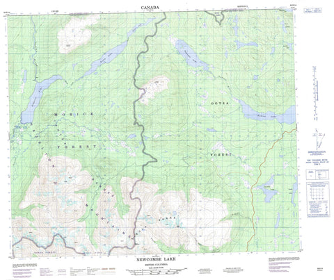
093E14 Newcombe Lake Canada topo map, 1:50,000 scale
093E14 Newcombe Lake NRCAN topographic map.
Includes UTM and GPS geographic coordinates (latitude and longitude). This 50k scale map is suitable for hiking, camping, and exploring, or you could frame it as a wall map.
Printed on-demand using high resolution, on heavy weight and acid free paper, or as an upgrade on a variety of synthetic materials.
Topos available on paper, Waterproof, Poly, or Tyvek. Usually shipping rolled, unless combined with other folded maps in one order.
- Product Number: NRCAN-093E14
- Parent Topo: TOPO-093E
- Map ID also known as: 093E14, 93E14
- Unfolded Size: Approximately 26" high by 36" wide
- Weight (paper map): ca. 55 grams
- Map Type: POD NRCAN Topographic Map
- Map Scale: 1:50,000
- Geographical region: British Columbia, Canada
Neighboring Maps:
All neighboring Canadian topo maps are available for sale online at 1:50,000 scale.
Purchase the smaller scale map covering this area: Topo-093E
Spatial coverage:
Topo map sheet 093E14 Newcombe Lake covers the following places:
- Anzac Lake - Duel Lakes - Hill-Tout Lake - Kidprice Lake - Nadina Lake - Needle Lake - Newcombe Lake - Star Lake - Stepp Lake - Tagetochlain Lake - Twinkle Lake - Hazelton Mountains - Mount Ney - Mount Sweeney - Sibola Mountains - Sibola Peak - Sibola Range - Smoke Mountain - Tableland Mountain - Tahtsa Ranges - Regional District of Bulkley-Nechako - Interior Plateau - Nechako Plateau - Bergeland Creek - Comb Creek - Nadina River - Nanika River - Sibola Creek - Stepp Creek - Tahtsa River - Whiting Creek


