
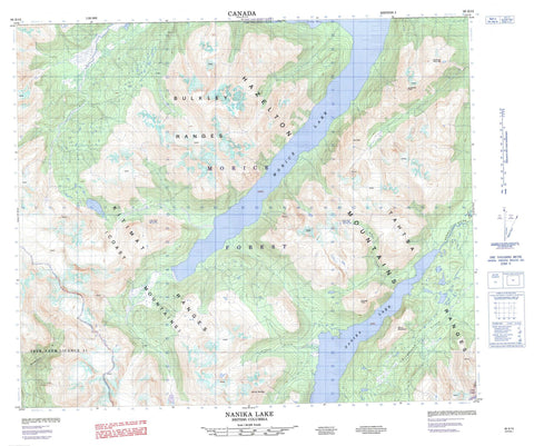
093E13 Nanika Lake Canada topo map, 1:50,000 scale
093E13 Nanika Lake NRCAN topographic map.
Includes UTM and GPS geographic coordinates (latitude and longitude). This 50k scale map is suitable for hiking, camping, and exploring, or you could frame it as a wall map.
Printed on-demand using high resolution, on heavy weight and acid free paper, or as an upgrade on a variety of synthetic materials.
Topos available on paper, Waterproof, Poly, or Tyvek. Usually shipping rolled, unless combined with other folded maps in one order.
- Product Number: NRCAN-093E13
- Parent Topo: TOPO-093E
- Map ID also known as: 093E13, 93E13
- Unfolded Size: Approximately 26" high by 36" wide
- Weight (paper map): ca. 55 grams
- Map Type: POD NRCAN Topographic Map
- Map Scale: 1:50,000
- Geographical region: British Columbia, Canada
Neighboring Maps:
All neighboring Canadian topo maps are available for sale online at 1:50,000 scale.
Purchase the smaller scale map covering this area: Topo-093E
Spatial coverage:
Topo map sheet 093E13 Nanika Lake covers the following places:
- Atna Bay - Full Moon Glacier - Lunar Glacier - New Moon Glacier - Shadow Glacier - Utem Glacier - UTEM Glacier - Morice Lake - Nanika Lake - Bulkley Ranges - Chaîne Côtière - Claw Ridge - Coast Mountains - Copper Wire Ridge - Hanging Glacier Mountain - Hazelton Mountains - Kitimat Ranges - Martello Mountain - Morice Range - Mount Bergeland - Mount Mortella - New Moon Mountain - Ob Peak - Passage Peak - Redslide Mountain - Snowcap Peak - Tahtsa Ranges - Regional District of Bulkley-Nechako - Regional District of Kitimat-Stikine - Interior Plateau - Nechako Plateau - Atna River - Bergeland Creek - Copper Cliff Creek - Dome Creek - Fenton Creek - Kemano River - Mortella Creek - Nanika River - Nikun Creek - Shadow Creek - Utem Creek - UTEM Creek


