
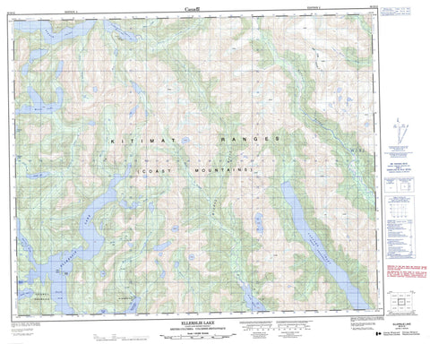
093D12 Ellerslie Lake Canada topo map, 1:50,000 scale
093D12 Ellerslie Lake NRCAN topographic map.
Includes UTM and GPS geographic coordinates (latitude and longitude). This 50k scale map is suitable for hiking, camping, and exploring, or you could frame it as a wall map.
Printed on-demand using high resolution, on heavy weight and acid free paper, or as an upgrade on a variety of synthetic materials.
Topos available on paper, Waterproof, Poly, or Tyvek. Usually shipping rolled, unless combined with other folded maps in one order.
- Product Number: NRCAN-093D12
- Parent Topo: TOPO-093D
- Map ID also known as: 093D12, 93D12
- Unfolded Size: Approximately 26" high by 36" wide
- Weight (paper map): ca. 55 grams
- Map Type: POD NRCAN Topographic Map
- Map Scale: 1:50,000
- Geographical region: British Columbia, Canada
Neighboring Maps:
All neighboring Canadian topo maps are available for sale online at 1:50,000 scale.
Purchase the smaller scale map covering this area: Topo-093D
Spatial coverage:
Topo map sheet 093D12 Ellerslie Lake covers the following places:
- Cascade Inlet - Kynoch Inlet - North Arm - Quartcha Bay - Roscoe Inlet - South Arm - Spiller Inlet - Coldwell Peninsula - Emily Peninsula - Dean Channel - Quartcha Indian Reserve 3 - Réserve indienne Quartcha 3 - Grace Island - Sadie Island - Culpepper Lagoon - Ellerslie Lagoon - Ellerslie Lake - Ingram Lake - Link Lake - Mooto Lake - Polallie Lake - Chaîne Côtière - Coast Mountains - Kitimat Ranges - Central Coast Regional District - Regional District of Kitimat-Stikine - Fiordland Recreation Area - Braden River - Ellerslie Creek - Grady Creek - Holt Creek - Kitlope River - Lard Creek - Lard River - Levi Creek - Nascall River - Near Creek - Polallie Creek - Quartcha Creek - Riot Creek - Roscoe Creek - Roscoe River - Ruth Creek


