
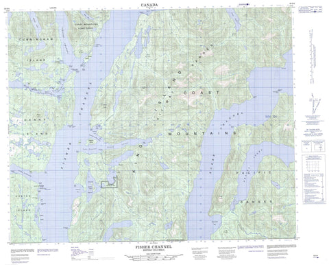
093D04 Fisher Channel Canada topo map, 1:50,000 scale
093D04 Fisher Channel NRCAN topographic map.
Includes UTM and GPS geographic coordinates (latitude and longitude). This 50k scale map is suitable for hiking, camping, and exploring, or you could frame it as a wall map.
Printed on-demand using high resolution, on heavy weight and acid free paper, or as an upgrade on a variety of synthetic materials.
Topos available on paper, Waterproof, Poly, or Tyvek. Usually shipping rolled, unless combined with other folded maps in one order.
- Product Number: NRCAN-093D04
- Parent Topo: TOPO-093D
- Map ID also known as: 093D04, 93D4, 93D04
- Unfolded Size: Approximately 26" high by 36" wide
- Weight (paper map): ca. 55 grams
- Map Type: POD NRCAN Topographic Map
- Map Scale: 1:50,000
- Geographical region: British Columbia, Canada
Neighboring Maps:
All neighboring Canadian topo maps are available for sale online at 1:50,000 scale.
Purchase the smaller scale map covering this area: Topo-093D
Spatial coverage:
Topo map sheet 093D04 Fisher Channel covers the following places:
- Bainbridge Cove - Beales Bay - Dunn Bay - Evans Inlet - Forit Bay - Goose Bay - Gosse Bay - Hampden Bay - Jenny Inlet - Kwatna Inlet - Lagoon Bay - Long Point Cove - Port John - Restoration Bay - The Trap - Anthony Point - Bernhardt Point - Bold Point - Brend Point - Carpenter Point - Clute Point - Denny Point - Draney Point - Dunn Point - Exeter Point - Farewell Point - Georgie Point - Hampden Point - Holti Point - Kaiete Point - Kelkpa Point - Long Point - Madigan Point - Mapalaklenk Point - Nob Point - Nyggard Point - Rattenbury Point - Salisbury Point - Septimus Point - Serpent Point - Shave Point - Start Point - Wakash Point - White Point - Burke Channel - Dean Channel - Fisher Channel - Gunboat Passage - Johnson Channel - Lama Passage - Luke Passage - Matthew Passage - Algerine Island - Boot Island - Clayton Island - Clitheroe Island - Codville Island - Cunningham Island - Dean Island - Denny Island - Dingle Island - Flirt Island - Hunter Island - King Island - Leila Island - Luke Island - Magee Islet - Maria Island - Matthew Island - Picture Island - Pointer Island - Stokes Island - Sunny Island - Teal Island - Beales Lagoon - Codville Lagoon - Four Lakes - Sagar Lake - Walker Lake - Webster Lake - Chaîne Côtière - Coast Mountains - Codville Hill - Corner Peak - Kitimat Ranges - Mount D'Arcy - Pacific Ranges - Salisbury Cone - Sharp Cone - Central Coast Regional District - Codville Lagoon Marine Park - Sagar Lake Park - Hook Nose Creek - Kunsoot River - Quatlena River - Scribner Creek - Bickford Rock - Mark Rock - Miller Rock - Odegaard Rocks - Peril Rock - Walbran Rock - White Top Rock


