
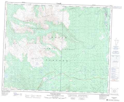
093C12 Tusulko River Canada topo map, 1:50,000 scale
093C12 Tusulko River NRCAN topographic map.
Includes UTM and GPS geographic coordinates (latitude and longitude). This 50k scale map is suitable for hiking, camping, and exploring, or you could frame it as a wall map.
Printed on-demand using high resolution, on heavy weight and acid free paper, or as an upgrade on a variety of synthetic materials.
Topos available on paper, Waterproof, Poly, or Tyvek. Usually shipping rolled, unless combined with other folded maps in one order.
- Product Number: NRCAN-093C12
- Parent Topo: TOPO-093C
- Map ID also known as: 093C12, 93C12
- Unfolded Size: Approximately 26" high by 36" wide
- Weight (paper map): ca. 55 grams
- Map Type: POD NRCAN Topographic Map
- Map Scale: 1:50,000
- Geographical region: British Columbia, Canada
Neighboring Maps:
All neighboring Canadian topo maps are available for sale online at 1:50,000 scale.
Purchase the smaller scale map covering this area: Topo-093C
Spatial coverage:
Topo map sheet 093C12 Tusulko River covers the following places:
- Blackwater Meadow Indian Reserve 11 - Réserve indienne Blackwater Meadow 11 - Réserve indienne Willow Meadow 9 - Willow Meadow Indian Reserve 9 - de Macedo Lakes - Ellis Lake - McCauley Lake - Octopus Lake - Scott Lake - Wilson Lake - Rainbow Mountains - Rainbow Range - Tsitsutl Peak - Cariboo Regional District - Central Coast Regional District - Tweedsmuir Park - Tweedsmuir Recreation Area - Fraser Plateau - Interior Plateau - Beef Trail Creek - Betty Creek - Dean River - Grizzly Creek - Natsadalia Creek - North Obsidian Creek - Obsidian Creek - Partridge Creek - Taiataeszi Creek - Taiateazi River - Tusulko River - Young Creek - Heckman Pass


