
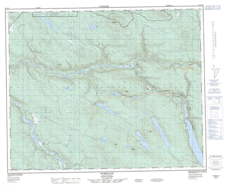
093A12 Hydraulic Canada topo map, 1:50,000 scale
093A12 Hydraulic NRCAN topographic map.
Includes UTM and GPS geographic coordinates (latitude and longitude). This 50k scale map is suitable for hiking, camping, and exploring, or you could frame it as a wall map.
Printed on-demand using high resolution, on heavy weight and acid free paper, or as an upgrade on a variety of synthetic materials.
Topos available on paper, Waterproof, Poly, or Tyvek. Usually shipping rolled, unless combined with other folded maps in one order.
- Product Number: NRCAN-093A12
- Parent Topo: TOPO-093A
- Map ID also known as: 093A12, 93A12
- Unfolded Size: Approximately 26" high by 36" wide
- Weight (paper map): ca. 55 grams
- Map Type: POD NRCAN Topographic Map
- Map Scale: 1:50,000
- Geographical region: British Columbia, Canada
Neighboring Maps:
All neighboring Canadian topo maps are available for sale online at 1:50,000 scale.
Purchase the smaller scale map covering this area: Topo-093A
Spatial coverage:
Topo map sheet 093A12 Hydraulic covers the following places:
- Bullion - Cedar Point - French Bar Bluffs - Gilbo Island - Bootjack Lake - Chambers Lake - Frypan Lake - Jackpine Lake - Jacobie Lake - Joan Lake - Kangaroo Lake - Le Bourdais Lake - Little Lake - Maud Lake - Morehead Lake - Opheim Lake - Passe Lake - Polley Lake - Poquette Lake - Prior Lake - Quesnel Lake - Rollie Lake - Rosette Lake - Slum Lake - Trio Lake - Wolverine Lake - Bootjack Mountain - Coyote Hill - Forks Mountain - Kangaroo Mountain - Maud Mountain - Mount Jacobie - Mount Morehead - Mount Polley - Quesnel Highland - Sister Mountain - Slide Mountain - Cariboo Regional District - Cedar Point Park - Fraser Plateau - Interior Plateau - 3 Mile Creek - Beaver Creek - Bilboa Creek - Birrell Creek - Bootjack Creek - Buxton Creek - Cariboo River - Cedar Creek - Chambers Creek - Chiaz Creek - Clayton Creek - Cub Creek - Dag Creek - Dago Creek - Dancing Bill Creek - Deerlet Creek - Dow Creek - Drop Creek - Ducks Creek - East Youngren Creek - Edney Creek - Ehle Creek - Fisher Creek - Fisherway Creek - Foley Creek - Forks Creek - Gallagher Creek - Grogan Creek - Hazeltine Creek - Jackpine Creek - Jacobie Creek - Kangaroo Creek - Lawlees Creek - Likely Gulch Creek - Little Creek - Little Lake Creek - Littlelake Creek - Mart Creek - Maud Creek - Meadowy Creek - Miles Creek - Morehead Creek - Murderer Creek - Poquette Creek - Quesnel River - Raft Creek - Ravine Creek - Rollie Creek - Rose Gulch Creek - Rudy Creek - Sam Creek - Sawmill Creek - Slide Creek - Slum Gulch Creek - Spinks Creek - Trio Creek - Victoria Creek - Warran Creek - Warren Creek - Westenhiser Creek - Youngren Creek - Hydraulic - Likely - Quesnel Forks - Trails End - Black Jack Gulch - Likely Gulch - Murderer Gulch - Rose Gulch - Twenty Mile Pass - Twentymile Pass - Big Wheel Flats


