
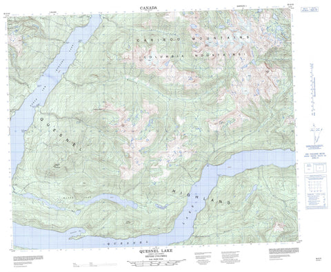
093A10 Quesnel Lake Canada topo map, 1:50,000 scale
093A10 Quesnel Lake NRCAN topographic map.
Includes UTM and GPS geographic coordinates (latitude and longitude). This 50k scale map is suitable for hiking, camping, and exploring, or you could frame it as a wall map.
Printed on-demand using high resolution, on heavy weight and acid free paper, or as an upgrade on a variety of synthetic materials.
Topos available on paper, Waterproof, Poly, or Tyvek. Usually shipping rolled, unless combined with other folded maps in one order.
- Product Number: NRCAN-093A10
- Parent Topo: TOPO-093A
- Map ID also known as: 093A10, 93A10
- Unfolded Size: Approximately 26" high by 36" wide
- Weight (paper map): ca. 55 grams
- Map Type: POD NRCAN Topographic Map
- Map Scale: 1:50,000
- Geographical region: British Columbia, Canada
Neighboring Maps:
All neighboring Canadian topo maps are available for sale online at 1:50,000 scale.
Purchase the smaller scale map covering this area: Topo-093A
Spatial coverage:
Topo map sheet 093A10 Quesnel Lake covers the following places:
- Lynx Bay - North Arm - Peninsula Bay - Bowling Point - Deception Point - Hunters Camp Point - Hurricane Point - Limestone Point - Marten Point - Welcome Point - Buckingham Lake - Quesnel Lake - Warttig Lake - Wasko Lakes - Cariboo Mountain - Columbia Mountains - Junction Mountain - Mount Lowry - Mount Watt - Mount Wotzke - Niagara Peak - Ogden Peak - Quartz Mountain - Quesnel Highland - Roaring Peaks - Three Ladies Mountain - Cariboo Regional District - Interior Plateau - Adams Creek - Bill Miner Creek - Bouldery Creek - Buckingham Creek - Devoe Creek - Franks Creek - Isaiah Creek - Long Creek - Lynx Creek - Marten Creek - Penfold Creek - Roaring River - Service Creek - Wasko Creek - Watt Creek


