
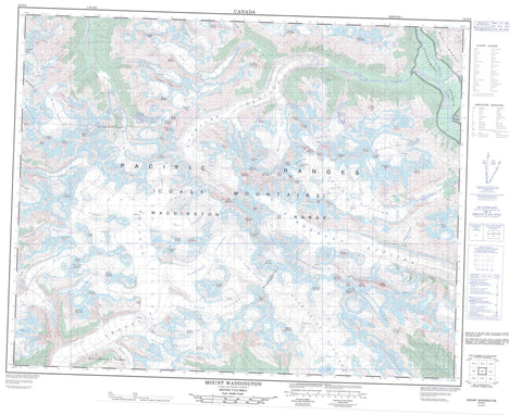
092N06 Mount Waddington Canada topo map, 1:50,000 scale
092N06 Mount Waddington NRCAN topographic map.
Includes UTM and GPS geographic coordinates (latitude and longitude). This 50k scale map is suitable for hiking, camping, and exploring, or you could frame it as a wall map.
Printed on-demand using high resolution, on heavy weight and acid free paper, or as an upgrade on a variety of synthetic materials.
Topos available on paper, Waterproof, Poly, or Tyvek. Usually shipping rolled, unless combined with other folded maps in one order.
- Product Number: NRCAN-092N06
- Parent Topo: TOPO-092N
- Map ID also known as: 092N06, 92N6, 92N06
- Unfolded Size: Approximately 26" high by 36" wide
- Weight (paper map): ca. 55 grams
- Map Type: POD NRCAN Topographic Map
- Map Scale: 1:50,000
- Geographical region: British Columbia, Canada
Neighboring Maps:
All neighboring Canadian topo maps are available for sale online at 1:50,000 scale.
Purchase the smaller scale map covering this area: Topo-092N
Spatial coverage:
Topo map sheet 092N06 Mount Waddington covers the following places:
- Icefall Point - Agur Glacier - Bell Glacier - Bert Glacier - Bravo Glacier - Breccia Glacier - Cannonade Glacier - Cataract Glacier - Chaos Glacier - Confederation Glacier - Corridor Glacier - Dais Glacier - Dauntless Glacier - Dorothy Glacier - Fan Glacier - Finality Glacier - Franklin Glacier - Fury Glacier - Geddes Glacier - Hoodoo Glacier - Ice Valley Glacier - Isolation Glacier - Jubilee Glacier - Malemute Glacier - Oval Glacier - Parallel Glacier - Portal Glacier - Radiant Glacier - Regal Glacier - Remote Glacier - Repose Glacier - Roovers Glacier - Scimitar Glacier - Shadow Glacier - Shelf Glacier - Shiverick Glacier - Smoking Canyon Glacier - Splendour Glacier - Sunrise Glacier - Tellot Glacier - Tiedemann Glacier - Waddington Glacier - Whitetip Glacier - Ephemeron Lake - Arabesque Peaks - Asperity Mountain - Barracuda Peaks - Bezel Peak - Bravo Peak - Breccia Mountain - Broad Peak - Cavalier Mountain - Centaur Peak - Chaîne Côtière - Chaos Peak - Claw Peak - Claw Peaks - Coast Mountains - Combatant Mountain - Crenelle Mountain - Cycloid Peak - Damocles Peak - Deception Peak - Dentiform Mountain - Dentiform Peak - Despair Peak - Disintegration Ridge - Dragonback Peak - Eaglehead Peak - Fascination Mountain - Finality Mountain - Fireworks Peak - Grenelle Mountain - Halberdier Mountain - Halberdier Peak - Hardship Mountain - Harkness Tower - Heartstone Peak - Hermit Peak - Irresistible Mountain - Jester Mountain - Martello Mountain - Merlon Mountain - Mount Agur - Mount Bell - Mount Chris Spencer - Mount Cornelia - Mount Dorothy - Mount Geddes - Mount Hickson - Mount Jeffery - Mount Marcus - Mount McCormick - Mount Mercator - Mount Munday - Mount Myrtle - Mount Roovers - Mount Schultz - Mount Shand - Mount Shiverick - Mount Tellot - Mount Tiedemann - Mount Waddington - Nightcap Mountain - Niut Range - Outpost Peak - Pacific Ranges - Pivot Peak - Pollex Mountain - Polydactyl Ridge - Privation Mountain - Projectile Mountain - Rainy Knob - Redbreast Mountain - Repose Mountain - Ribbon Peak - Sepia Mountain - Serra Peaks - Sierra Peak - Skean Peak - Sockeye Peak - Spearman Peak - Steppenwolf Mountain - Stiletto Mountain - Stiletto Peak - Termination Peak - Threshold Peak - Trylon Peak - Umbra Mountain - Unicorn Mountain - Waddington Range - Whitemantle Range - Whitetip Mountain - Whymper Dome - Regional District of Comox-Strathcona - Regional District of Mount Waddington - Cataract Creek - Five Finger Creek - Hoodoo Creek - Mercator Creek - Mosley Creek - Remote Creek - Saffron Creek - Scimitar Creek - Tellot Creek - Cataract Col - Echo Col - Fury Gap - Nabob Pass - Pocket Valley


