
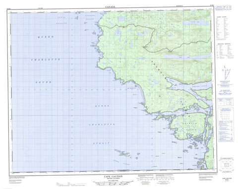
092M04 Cape Caution Canada topo map, 1:50,000 scale
092M04 Cape Caution NRCAN topographic map.
Includes UTM and GPS geographic coordinates (latitude and longitude). This 50k scale map is suitable for hiking, camping, and exploring, or you could frame it as a wall map.
Printed on-demand using high resolution, on heavy weight and acid free paper, or as an upgrade on a variety of synthetic materials.
Topos available on paper, Waterproof, Poly, or Tyvek. Usually shipping rolled, unless combined with other folded maps in one order.
- Product Number: NRCAN-092M04
- Parent Topo: TOPO-092M
- Map ID also known as: 092M04, 92M4, 92M04
- Unfolded Size: Approximately 26" high by 36" wide
- Weight (paper map): ca. 55 grams
- Map Type: POD NRCAN Topographic Map
- Map Scale: 1:50,000
- Geographical region: British Columbia, Canada
Neighboring Maps:
All neighboring Canadian topo maps are available for sale online at 1:50,000 scale.
Purchase the smaller scale map covering this area: Topo-092M
Spatial coverage:
Topo map sheet 092M04 Cape Caution covers the following places:
- Allison Harbour - Belize Inlet - Blunden Bay - Burnett Bay - Cougar Inlet - Hoop Bay - Indian Cove - Jones Cove - Lassiter Bay - Miles Inlet - Protection Cove - Queen Charlotte Sound - Rowley Bay - Seymour Inlet - Silvester Bay - Skull Cove - Treadwell Bay - Vigilance Cove - Barrow Point - Boot Point - Bramham Point - Bremner Point - Buccleugh Point - Cape Caution - City Point - Dalkeith Point - Digby Point - Goose Point - Johnson Point - Jones Point - Kitching Point - Lascelles Point - Macnicol Point - McEwan Point - Mignon Point - Milthorp Point - Neck Ness - Quiet Point - Raynor Point - Slingsby Point - Stream Point - Town Point - Vigilance Point - Wilkie Point - Alexandra Passage - Europa Passage - Outer Narrows - Queen Charlotte Strait - Schooner Channel - Schooner Passage - Slingsby Channel - South Passage - Dedagaus Indian Reserve 8 - Khazisela Indian Reserve 7 - Réserve indienne Dedagaus 8 - Réserve indienne Khazisela 7 - Réserve indienne Saagoombahlah 6 - Réserve indienne Ta-a-ack 5 - Saagoombahlah Indian Reserve 6 - Ta-a-ack Indian Reserve 5 - Anchor Islands - Bramham Island - Bremner Islet - Butress Island - Deloraine Islands - Egg Island - Eliza Islands - Emily Group - Eno Island - Fox Islands - Frederick Islands - Guard Island - Harris Island - Helm Island - Knight Island - Mayor Island - Murray Labyrinth - Naiad Islets - New Island - Oar Island - Ray Island - Reid Islets - Rogers Islands - Roy Islet - Southgate Group - Southgate Island - Stevens Island - Storm Islands - White Island - Bertha Lake - Leonora Lake - Long Hike Lake - Pack Lake - Allison Cone - Baker Range - Coast Mountains - Coast Nipple - Flat Hill - Fraser Range - Harbour Hill - Harbour Peak - Lump Hill - Mount Robinson - Nina Hill - Noel Hill - Pacific Ranges - Central Coast Regional District - Regional District of Mount Waddington - Evader Creek - Matheson Creek - Ringland Creek - Takush River - Nakwakto Rapids - Allan Rocks - Allison Reefs - Blind Reef - Denny Rock - Dickenson Rock - Dominis Rocks - Egg Rocks - Elizabeth Rocks - Guard Rock - Hannah Rocks - Hayes Rock - Hoop Reef - Jezzard Rock - Lama Shoal - McEwan Rock - Middle Rocks - Morphy Rock - North Iron Rock - Sealed Reef - Slater Rocks - Slingsby Rock - South Iron Rock - South Rocks - Ta-aack Rock - Town Rock - Turret Rock - Woods Rock - Wright Bank - Allison Harbour


