
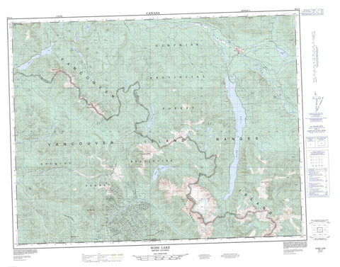
092L02 Woss Lake Canada topo map, 1:50,000 scale
092L02 Woss Lake NRCAN topographic map.
Includes UTM and GPS geographic coordinates (latitude and longitude). This 50k scale map is suitable for hiking, camping, and exploring, or you could frame it as a wall map.
Printed on-demand using high resolution, on heavy weight and acid free paper, or as an upgrade on a variety of synthetic materials.
Topos available on paper, Waterproof, Poly, or Tyvek. Usually shipping rolled, unless combined with other folded maps in one order.
- Product Number: NRCAN-092L02
- Parent Topo: TOPO-092L
- Map ID also known as: 092L02, 92L2, 92L02
- Unfolded Size: Approximately 26" high by 36" wide
- Weight (paper map): ca. 55 grams
- Map Type: POD NRCAN Topographic Map
- Map Scale: 1:50,000
- Geographical region: British Columbia, Canada
Neighboring Maps:
All neighboring Canadian topo maps are available for sale online at 1:50,000 scale.
Purchase the smaller scale map covering this area: Topo-092L
Spatial coverage:
Topo map sheet 092L02 Woss Lake covers the following places:
- Atluck Lake - Frost Lake - Hoomak Lake - Kaipit Lake - Mukwilla Lake - Rice Lake - Tsiko Lake - Wolfe Lake - Woss Lake - Zeballos Lake - Haihte Range - Haithe Range - Kainum Mountain - Kaouk Mountain - Lukwa Mountain - Mamat Mountain - Mook Peak - Mount Markusen - Pinder Mountain - Pinder Peak - Rugged Mountain - Vancouver Island Mountains - Vancouver Island Ranges - Woss Mountain - Zeballos Mountain - Zeballos Peak - Regional District of Comox-Strathcona - Regional District of Mount Waddington - Artlish Caves Park - Woss Lake Park - Artlish River - Atluck Creek - Bibb Creek - Blacksand Creek - Canyon Creek - Curly Creek - Davie River - Espinosa Creek - Fault Creek - Golden Gate Creek - Goldvalley Creek - Haida Creek - Hidden Valley Creek - Kaipit Creek - Kaouk River - Kiyu Creek - Lime Creek - Lukwa Creek - Maquinna Creek - Marble River - McIver Creek - Monckton Creek - Mukwilla Creek - Nomash River - Pandora Creek - Pinder Creek - Privateer Creek - Rice Creek - Rimy Creek - Rowland Creek - Spud Creek - Tahsis River - Teisum Creek - Tsiko Creek - Van Isle Creek - Woss River - Yookwa Creek - Zeballos River - Atluck - Woss - Woss Camp


