
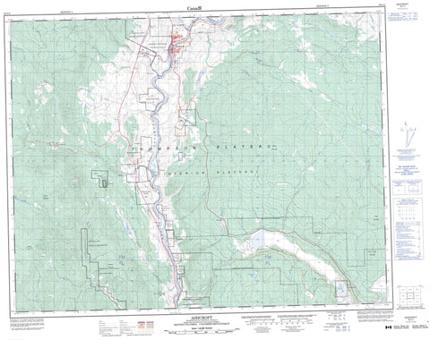
092I11 Ashcroft Canada topo map, 1:50,000 scale
092I11 Ashcroft NRCAN topographic map.
Includes UTM and GPS geographic coordinates (latitude and longitude). This 50k scale map is suitable for hiking, camping, and exploring, or you could frame it as a wall map.
Printed on-demand using high resolution, on heavy weight and acid free paper, or as an upgrade on a variety of synthetic materials.
Topos available on paper, Waterproof, Poly, or Tyvek. Usually shipping rolled, unless combined with other folded maps in one order.
- Product Number: NRCAN-092I11
- Parent Topo: TOPO-092I
- Map ID also known as: 092I11, 92I11
- Unfolded Size: Approximately 26" high by 36" wide
- Weight (paper map): ca. 55 grams
- Map Type: POD NRCAN Topographic Map
- Map Scale: 1:50,000
- Geographical region: British Columbia, Canada
Neighboring Maps:
All neighboring Canadian topo maps are available for sale online at 1:50,000 scale.
Purchase the smaller scale map covering this area: Topo-092I
Spatial coverage:
Topo map sheet 092I11 Ashcroft covers the following places:
- 105 Mile Post Indian Reserve 2 - Ashcroft Indian Reserve 4 - Basque Indian Reserve 18 - Basque Indian Reserve 18 - Cheetsum's Farm Indian Reserve 1 - Hay Meadow Indian Reserve 1 - Nicoelton Indian Reserve 6 - Oregon Jack Creek Indian Reserve 2 - Oregon Jack Creek Indian Reserve 3 - Oregon Jack Creek Indian Reserve 5 - Pemynoos Indian Reserve 9 - Peq-Paq 22 - Peq-paq Indian Reserve 22 - Pokheitsk Indian Reserve 10 - Réserve indienne 105 Mile Post 2 - Réserve indienne Ashcroft 4 - Réserve indienne Basque 18 - Réserve indienne Cheetsum's Farm 1 - Réserve indienne Hay Meadow 1 - Réserve indienne Nicoelton 6 - Réserve indienne Oregon Jack Creek 2 - Réserve indienne Oregon Jack Creek 3 - Réserve indienne Oregon Jack Creek 5 - Réserve indienne Pemynoos 9 - Réserve indienne Peq-paq 22 - Réserve indienne Pokheitsk 10 - Réserve indienne Shpapzchinh 20 - Réserve indienne South Nepa 7 - Réserve indienne Spatsum 11 - Réserve indienne Spatsum 11A - Réserve indienne Upper Nepa 6 - Réserve indienne Upper Tsinkahtl 8A - Shpapzchinh Indian Reserve 20 - South Nepa Indian Reserve 7 - Spatsum Indian Reserve 11 - Spatsum Indian Reserve 11A - Upper Nepa Indian Reserve 6 - Upper Tsinkahtl Indian Reserve 8A - Barnes Lake - Big Divide Lake - Blue Earth Lake - Jim Black Lake - Nesbitt Lake - Pennie Lake - Separating Lake - Twaal Lake - Twentyfour Mile Lake - Twin Lakes - Venables Lake - Willard Lake - Cinder Hill - Cornwall Hills - Forge Mountain - Glossy Mountain - Lookout Point - Nicoelton Mountain - Oregon Jack Hill - Red Hill - South Forge Mountain - White Mountain - Bedard Aspen Park - Blue Earth Lake Park - Cornwall Hills Park - Elephant Hill Park - Epsom Park - Oregon Jack Park - Boston Flats - Thompson Plateau - Ambusten Creek - Ashcroft Creek - Barnard Creek - Barnes Creek - Blue Earth Creek - Bonaparte River - Boyes Creek - Burr Creek - Cheetsum Creek - Coldstream Creek - Cornwall Creek - East Murray Creek - Forge Creek - Guichon Creek - Hume Creek - Klootchville Creek - Lone Tree Creek - Medicine Creek - Minaberriet Creek - Oregon Jack Creek - Puckett Creek - Pukaist Creek - Spatsum Creek - Spence Creek - Studhorse Creek - Thompson River - Three Sisters Creek - Tremont Creek - Twaal Creek - Venables Creek - Woods Creek - Abrahamson - Basque - Epsom - Munroe - Nepa - Spatsum - Toketic - Black Canyon - Brassy Gulch - Venables Valley - Ashcroft


