
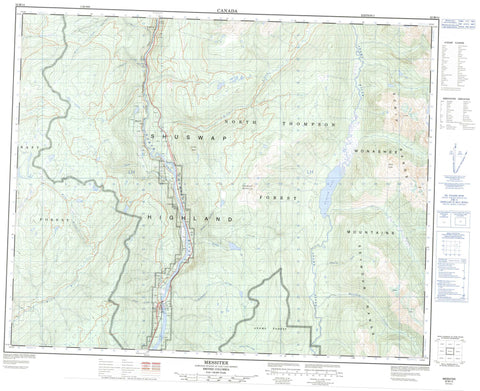
082M14 Messiter Canada topo map, 1:50,000 scale
082M14 Messiter NRCAN topographic map.
Includes UTM and GPS geographic coordinates (latitude and longitude). This 50k scale map is suitable for hiking, camping, and exploring, or you could frame it as a wall map.
Printed on-demand using high resolution, on heavy weight and acid free paper, or as an upgrade on a variety of synthetic materials.
Topos available on paper, Waterproof, Poly, or Tyvek. Usually shipping rolled, unless combined with other folded maps in one order.
- Product Number: NRCAN-082M14
- Parent Topo: TOPO-082M
- Map ID also known as: 082M14, 82M14
- Unfolded Size: Approximately 26" high by 36" wide
- Weight (paper map): ca. 55 grams
- Map Type: POD NRCAN Topographic Map
- Map Scale: 1:50,000
- Geographical region: British Columbia, Canada
Neighboring Maps:
All neighboring Canadian topo maps are available for sale online at 1:50,000 scale.
Purchase the smaller scale map covering this area: Topo-082M
Spatial coverage:
Topo map sheet 082M14 Messiter covers the following places:
- Lower Messiter Lake - Messiter Lake - Tumtum Lake - Columbia Mountains - Groundhog Mountain - Monashee Mountains - Mount Foster - Pinkie Peak - Scrip Range - Seymour Range - Shuswap Highland - Finn Creek Park - Interior Plateau - Porte d'Enfer Rapids - Adams River - Avola Creek - Berry Creek - Camp Six Creek - Cayuse Creek - Finn Creek - Lampard Creek - Lion Creek - Lyon Creek - Mad River - Mammoth Creek - Oliver Creek - Shannon Creek - Snowball Creek - Stratton Creek - Sundt Creek - Tumtum Creek - Avola - Cottonwood Flats - Messiter - Wolfenden - Porte d'Enfer Canyon - Cottonwood Flats


