
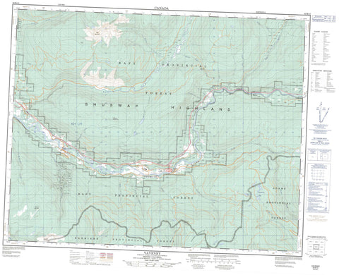
082M12 Vavenby Canada topo map, 1:50,000 scale
082M12 Vavenby NRCAN topographic map.
Includes UTM and GPS geographic coordinates (latitude and longitude). This 50k scale map is suitable for hiking, camping, and exploring, or you could frame it as a wall map.
Printed on-demand using high resolution, on heavy weight and acid free paper, or as an upgrade on a variety of synthetic materials.
Topos available on paper, Waterproof, Poly, or Tyvek. Usually shipping rolled, unless combined with other folded maps in one order.
- Product Number: NRCAN-082M12
- Parent Topo: TOPO-082M
- Map ID also known as: 082M12, 82M12
- Unfolded Size: Approximately 26" high by 36" wide
- Weight (paper map): ca. 55 grams
- Map Type: POD NRCAN Topographic Map
- Map Scale: 1:50,000
- Geographical region: British Columbia, Canada
Neighboring Maps:
All neighboring Canadian topo maps are available for sale online at 1:50,000 scale.
Purchase the smaller scale map covering this area: Topo-082M
Spatial coverage:
Topo map sheet 082M12 Vavenby covers the following places:
- Avery Lake - Graffunder Lakes - McCorvie Lake - Running Bear Lake - Foghorn Mountain - Granite Mountain - Mount McClennan - Raft Mountain - Sentry Mountain - Shuswap Highland - Vavenby Mountain - Caligata Lake Park - Interior Plateau - Avery Creek - Baker Creek - Barriere River - Barrière River - Barton Creek - Bill Creek - Blackberg Creek - Blowhole Creek - Burton Creek - Butler Creek - Cabin Creek - Candle Creek - Chuck Creek - Clay Creek - Cornet Creek - Cove Creek - Crossing Creek - Divide Creek - Finley Creek - Foghorn Creek - Harper Creek - Hascheak Creek - Jake Creek - Johnston Creek - Jones Creek - Joseph Creek - Lute Creek - Mad Creek - Mad River - Martin Creek - McCorvie Creek - McDougal Creek - Moilliet Creek - Montanna Creek - Noblequartz Creek - Peavine Creek - Raft River - Reg Christie Creek - Regchristie Creek - Robert Creek - School Creek - Spahats Creek - Willis Creek - Birch Island - Irvine - Vavenby - Wabron - Hole in the Wall


