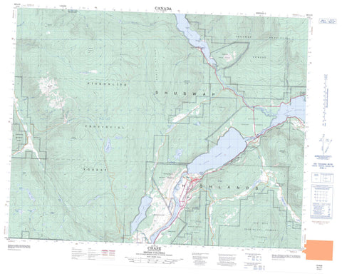
082L13 Chase Canada topo map, 1:50,000 scale
082L13 Chase NRCAN topographic map.
Includes UTM and GPS geographic coordinates (latitude and longitude). This 50k scale map is suitable for hiking, camping, and exploring, or you could frame it as a wall map.
Printed on-demand using high resolution, on heavy weight and acid free paper, or as an upgrade on a variety of synthetic materials.
Topos available on paper, Waterproof, Poly, or Tyvek. Usually shipping rolled, unless combined with other folded maps in one order.
- Product Number: NRCAN-082L13
- Parent Topo: TOPO-082L
- Map ID also known as: 082L13, 82L13
- Unfolded Size: Approximately 26" high by 36" wide
- Weight (paper map): ca. 55 grams
- Map Type: POD NRCAN Topographic Map
- Map Scale: 1:50,000
- Geographical region: British Columbia, Canada
Neighboring Maps:
All neighboring Canadian topo maps are available for sale online at 1:50,000 scale.
Purchase the smaller scale map covering this area: Topo-082L
Spatial coverage:
Topo map sheet 082L13 Chase covers the following places:
- Indigo Bay - McKay Bay - Cruickshank Point - McLeod Point - Meeks Point - Woolford Point - Wulfrid Point - Chum Creek Indian Reserve 2 - Hustalen Indian Reserve 1 - Meadow Creek Indian Reserve 3 - Neskainlith Indian Reserve 1 - Neskainlith Indian Reserve 2 - Neskonlith Indian Reserve 1 - Neskonlith Indian Reserve 2 - Quaaout Indian Reserve 1 - Réserve indienne Chum Creek 2 - Réserve indienne Hustalen 1 - Réserve indienne Meadow Creek 3 - Réserve indienne Neskainlith 1 - Réserve indienne Neskainlith 2 - Réserve indienne Neskonlith 1 - Réserve indienne Neskonlith 2 - Réserve indienne Quaaout 1 - Réserve indienne Sahhaltkum 4 - Réserve indienne Scotch Creek 4 - Réserve indienne Stequmwhulpa 5 - Réserve indienne Toops 3 - Sahhaltkum Indian Reserve 4 - Scotch Creek Indian Reserve 4 - Stequmwhulpa Indian Reserve 5 - Toops Indian Reserve 3 - Aylmer Lake - Banshee Lake - Bray Lake - Cahilty Lake - Chum Lake - Dennis Lake - Eileen Lake - Fadear Lake - Fleming Lake - Hadlow Lake - Hyas Lake - Kosta Lake - Little McGillivray Lake - Little Shuswap Lake - McGillivray Lake - Morrisey Lake - Niskonlith Lake - Pemberton Lake - Phillips Lake - Rhoda Lake - Shuswap Lake - Skmana Lake - Warren Lake - Adams Hill - Bruhn Ridge - Mount Boysse - Mount Cahilty - Mount Leslie - Mount Morrisey - Mount Scatchard - Mount Tod - Ptarmigan Hills - Shaw Hill - Shuswap Highland - Squilax Mountain - Tsalkom Mountain - Columbia-Shuswap Regional District - Adams Lake - Poplar Point Park - Adams Lake Park - Adams Lake Recreation Area - Adams River Recreation Area - Hiuihil Creek Park - Niskonlith Lake Park - Niskonlith Lake Recreation Area - Roderick Haig-Brown Conservation Area - Roderick Haig-Brown Park - Roderick Haig-Brown Recreation Area - Thompson Plateau - Adams River - Agnes Creek - Armitage Creek - Botticelli Creek - Bruhn Creek - Bush Creek - Cahilty Creek - Chase Creek - Chee Creek - Christian Creek - Chum Creek - Corning Creek - Fadear Creek - Gulch Creek - Hazel Creek - Henderson Creek - Hiuihill Creek - Hustalen Creek - Kelowna Creek - Little River - Loakin Creek - Louis Creek - McAuliffe Creek - McGillivray Creek - McKnight Creek - Nikwikwaia Creek - Niskonlith Creek - Paling Creek - Paul Creek - Resort Creek - Scotch Creek - Skimikin Creek - Skmana Creek - South Thompson River - Woolford Creek - Adams Lake - Elson - Lee Creek - Shuswap - Squilax - Stormont - Sun Peaks - Turtle Valley - Split Toe Gulch - Turtle Valley - Chase

