
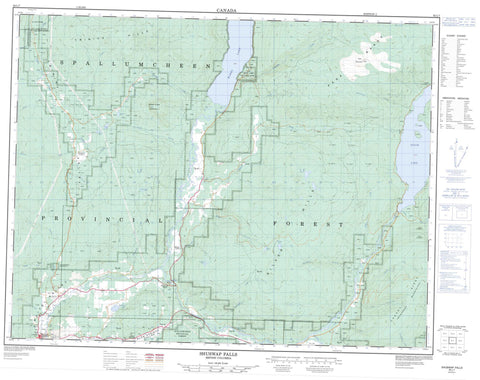
082L07 Shuswap Falls Canada topo map, 1:50,000 scale
082L07 Shuswap Falls NRCAN topographic map.
Includes UTM and GPS geographic coordinates (latitude and longitude). This 50k scale map is suitable for hiking, camping, and exploring, or you could frame it as a wall map.
Printed on-demand using high resolution, on heavy weight and acid free paper, or as an upgrade on a variety of synthetic materials.
Topos available on paper, Waterproof, Poly, or Tyvek. Usually shipping rolled, unless combined with other folded maps in one order.
- Product Number: NRCAN-082L07
- Parent Topo: TOPO-082L
- Map ID also known as: 082L07, 82L7, 82L07
- Unfolded Size: Approximately 26" high by 36" wide
- Weight (paper map): ca. 55 grams
- Map Type: POD NRCAN Topographic Map
- Map Scale: 1:50,000
- Geographical region: British Columbia, Canada
Neighboring Maps:
All neighboring Canadian topo maps are available for sale online at 1:50,000 scale.
Purchase the smaller scale map covering this area: Topo-082L
Spatial coverage:
Topo map sheet 082L07 Shuswap Falls covers the following places:
- Brenda Falls - Shuswap Falls - Beaverjack Lake - Christian Lake - Christien Lake - Conn Lake - Holstein Lake - Kathy Lake - Mabel Lake - Pritchard Lake - Rawlings Lake - Seidner Lake - Sugar Lake - Bobbie Burns Mountain - Cherry Ridge - Columbia Mountains - Monashee Mountains - Mount Bobbie Burns - Park Mountain - Park Range - Shuswap Highland - Silver Hills - Trinity Hills - Regional District of North Okanagan - Mabel Lake Park - Alberts Creek - Beaverjack Creek - Bessette Creek - Bigg Creek - Blue Springs Creek - Buchanan Creek - Burnyeat Creek - Cartwright Creek - Cherry Creek - Christian Creek - Christien Creek - Deafies Creek - Duteau Creek - Fairbrother Creek - Gallon Creek - Gilbert Creek - Gilder Creek - Holstein Creek - Ireland Creek - Latewhos Creek - Lossie Creek - Lossy Creek - Miriam Creek - Oleen Creek - Outlet Creek - Putnam Creek - Reiter Creek - Sanesh Creek - Sauff Creek - Schunter Creek - Shuswap River - Sowsap Creek - Specht Creek - Sprockton Creek - Star Creek - Styx Creek - Taylor Creek - Trinity Creek - Vance Creek - Vlem Creek - Woodward Creek - Blue Springs - Mabel Lake - Reiswig - Shuswap Falls - Trinity Valley - Blue Springs Valley - Trinity Valley - White Valley - Lumby


