
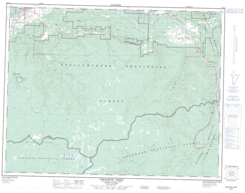
082L02 Creighton Creek Canada topo map, 1:50,000 scale
082L02 Creighton Creek NRCAN topographic map.
Includes UTM and GPS geographic coordinates (latitude and longitude). This 50k scale map is suitable for hiking, camping, and exploring, or you could frame it as a wall map.
Printed on-demand using high resolution, on heavy weight and acid free paper, or as an upgrade on a variety of synthetic materials.
Topos available on paper, Waterproof, Poly, or Tyvek. Usually shipping rolled, unless combined with other folded maps in one order.
- Product Number: NRCAN-082L02
- Parent Topo: TOPO-082L
- Map ID also known as: 082L02, 82L2, 82L02
- Unfolded Size: Approximately 26" high by 36" wide
- Weight (paper map): ca. 55 grams
- Map Type: POD NRCAN Topographic Map
- Map Scale: 1:50,000
- Geographical region: British Columbia, Canada
Neighboring Maps:
All neighboring Canadian topo maps are available for sale online at 1:50,000 scale.
Purchase the smaller scale map covering this area: Topo-082L
Spatial coverage:
Topo map sheet 082L02 Creighton Creek covers the following places:
- Barbe Lakes - Bisson Lake - Bonneau Lake - Clier Lake - Denison Lake - Echo Lake - Ferry Lake - Fish Hawk Lakes - Goat Mountain Lake - Grazer Lake - Harris Lake - Home Lake - Jerry Lake - Jerry Lakes - Lees Lake - Lily Pad Lake - McIntyre Lake - Mission Lake - Mosquito Lake - Murray Lake - Nahm Lake - Nicklen Lake - Thelma Lake - Buck Hills - Buck Mountain - Camels Hump - Columbia Mountains - Midway Range - Monashee Mountains - Okanagan Highland - Satellite Hill - Shuswap Highland - Regional District of Central Okanagan - Echo Lake Park - Interior Plateau - Thompson Plateau - Beetle Creek - Bessette Creek - Big Goat Creek - Bisson Creek - Blue Springs Creek - Bonneau Creek - Bruer Creek - Cherry Creek - Coalgoat Creek - Creighton Creek - Crib Creek - Currie Creek - Dutchman Creek - Duteau Creek - Fairbrother Creek - Ferry Creek - Fish Creek - Fish Hawk Creek - Gal Creek - Half Mile Creek - Harris Creek - Heart Creek - Heckman Creek - Home Creek - Inches Creek - Jacks Creek - Kettle River - McAuley Creek - McIntyre Creek - Mike Creek - Mission Creek - Monashee Creek - Monashee Pass Creek - Murray Creek - Nicklen Creek - Paradise Creek - Shuswap River - Stoplog Creek - Strutell Creek - Vidler Creek - West Bruer Creek - West Harris Creek - Woodmouse Creek - Yeoward Creek - Cherryville - Creighton Valley - Hilton - Blue Springs Valley - Creighton Valley - Monashee Pass - White Valley - Lumby


