
082G02 Inverted Ridge Canada topo map, 1:50,000 scale
082G02 Inverted Ridge NRCAN topographic map.
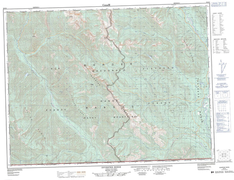
Includes UTM and GPS geographic coordinates (latitude and longitude). This 50k scale map is suitable for hiking, camping, and exploring, or you could frame it as a wall map.
Printed on-demand using high resolution, on heavy weight and acid free paper, or as an upgrade on a variety of synthetic materials.
Topos available on paper, Waterproof, Poly, or Tyvek. Usually shipping rolled, unless combined with other folded maps in one order.
- Product Number: NRCAN-082G02
- Parent Topo: TOPO-082G
- Map ID also known as: 082G02, 82G2, 82G02
- Unfolded Size: Approximately 26" high by 36" wide
- Weight (paper map): ca. 55 grams
- Map Type: POD NRCAN Topographic Map
- Map Scale: 1:50,000
- Geographical region: British Columbia, Canada
Neighboring Maps:
All neighboring Canadian topo maps are available for sale online at 1:50,000 scale.
Purchase the smaller scale map covering this area: Topo-082G
Spatial coverage:
Topo map sheet 082G02 Inverted Ridge covers the following places:
- Beryl Lake - Frozen Lake - Hunger Lake - Marl Lake - Snowshoe Lake - Teds Lake - Border Ranges - Clark Range - Clarke Range - Couldrey Ridge - Dally Hill - Galton Range - Gold Mountain - Inverted Ridge - Macdonald Range - Montagnes Rocheuses - Mount Doupe - Mount Hefty - Mount Mahaney - Mount Swope - Outlier Ridge - Overfold Mountain - Piaysoo Ridge - Rocky Mountains - Soowa Mountain - Trachyte Ridge - Regional District of East Kootenay - Beryl Creek - Bighorn Creek - Blacktail Creek - Blower Creek - Burnham Creek - Cabin Creek - Calder Creek - Cate Creek - Couldrey Creek - Desolation Creek - Elfin Creek - Fenster Creek - Flathead River - Gumbo Creek - Harvey Creek - Howell Creek - Leslie Creek - Middlepass Creek - Miller Creek - Parker Creek - Phillipps Creek - Rabbit Creek - Rainbow Creek - Storm Creek - Twentynine Mile Creek - Weasel Creek - West Kisoo Creek - Wigwam River - Wutluk Creek - Akatl Pass - Cabin Pass - Flathead Basin - Galton Pass - Kisoo Pass


