
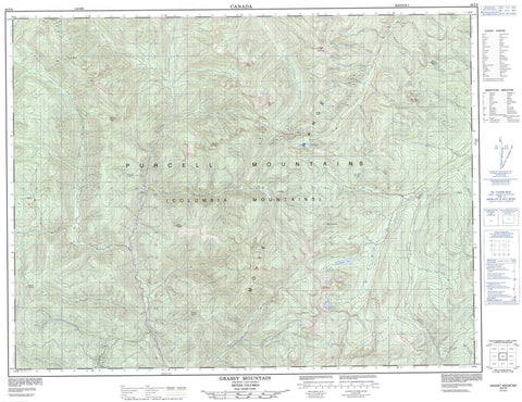
082F08 Grassy Mountain Canada topo map, 1:50,000 scale
082F08 Grassy Mountain NRCAN topographic map.
Includes UTM and GPS geographic coordinates (latitude and longitude). This 50k scale map is suitable for hiking, camping, and exploring, or you could frame it as a wall map.
Printed on-demand using high resolution, on heavy weight and acid free paper, or as an upgrade on a variety of synthetic materials.
Topos available on paper, Waterproof, Poly, or Tyvek. Usually shipping rolled, unless combined with other folded maps in one order.
- Product Number: NRCAN-082F08
- Parent Topo: TOPO-082F
- Map ID also known as: 082F08, 82F8, 82F08
- Unfolded Size: Approximately 26" high by 36" wide
- Weight (paper map): ca. 55 grams
- Map Type: POD NRCAN Topographic Map
- Map Scale: 1:50,000
- Geographical region: British Columbia, Canada
Neighboring Maps:
All neighboring Canadian topo maps are available for sale online at 1:50,000 scale.
Purchase the smaller scale map covering this area: Topo-082F
Spatial coverage:
Topo map sheet 082F08 Grassy Mountain covers the following places:
- Cooper Lake - Richmond Lake - Yeko Lake - Columbia Mountains - Gillis Peak - Grassy Mountain - Mount Armitage - Mount Bigattini - Mount Bohan - Mount Cowley - Mount Flett - Mount O'Neill - Mount Pudifin - Mount Sommerfeld - Moyie Range - Old Baldy Mountain - Purcell Mountains - Putnam Peak - Regional District of East Kootenay - Kianuko Park - Angus Creek - Arrow Creek - Bohan Creek - Bonton Creek - Boulder Creek - Cameron Creek - Cooper Creek - Galway Creek - Goat River - Hall Creek - Hellroaring Creek - Irishman Creek - Kamma Creek - Kianuko Creek - Kid Creek - Kutlits Creek - Kuttat Creek - Lake Creek - Lamb Creek - Lamb Creek - Leadville Creek - Lewis Creek - Limerick Creek - Liverpool Creek - London Creek - Lovola Creek - Mallandaine Creek - Manchester Creek - McNeil Creek - Meachen Creek - Moyie River - Moyie-North Creek - Negro Creek - Noke Creek - North MoyieCreek - Perry Creek - Ridgeway Creek - Ryder Creek - Shorty Creek - Skelly Creek - South Moyie Creek - Walsh Creek - Waverley Creek - Weaver Creek - Wuho Creek - Wuhun Creek


