
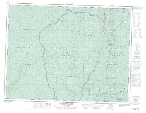
082E11 Wilkinson Creek Canada topo map, 1:50,000 scale
082E11 Wilkinson Creek NRCAN topographic map.
Includes UTM and GPS geographic coordinates (latitude and longitude). This 50k scale map is suitable for hiking, camping, and exploring, or you could frame it as a wall map.
Printed on-demand using high resolution, on heavy weight and acid free paper, or as an upgrade on a variety of synthetic materials.
Topos available on paper, Waterproof, Poly, or Tyvek. Usually shipping rolled, unless combined with other folded maps in one order.
- Product Number: NRCAN-082E11
- Parent Topo: TOPO-082E
- Map ID also known as: 082E11, 82E11
- Unfolded Size: Approximately 26" high by 36" wide
- Weight (paper map): ca. 55 grams
- Map Type: POD NRCAN Topographic Map
- Map Scale: 1:50,000
- Geographical region: British Columbia, Canada
Neighboring Maps:
All neighboring Canadian topo maps are available for sale online at 1:50,000 scale.
Purchase the smaller scale map covering this area: Topo-082E
Spatial coverage:
Topo map sheet 082E11 Wilkinson Creek covers the following places:
- Knob Point - Acme Lake - Arlington Lakes - Barge Lake - Big Meadow Lake - Canyon Lakes - Corporation Lake - Crawford Lake - Dale Lake - Deep Lake - Duncan Lake - Goathide Lake - Graham Lake - Greyback Lake - Haynes Lake - Howard Lake - Idabel Lake - Idleback Lake - Lower Barge Lake - McCulloch Reservoir - Mile High Lakes - Nuttall Lake - Ratnip Lake - Reed Lake - Stump Lake - Turnbull Lake - Turtle Lake - Wallace Lake - Arlington Mountain - Beaverdell Range - China Butte - China Ridge - Clapperton Hill - Crystal Butte - Crystal Mountain - Ferroux Mountain - Greyback Mountain - King Solomon Mountain - Little Nipple - Little White Mountain - Mount Atkinson - Mount Ferroux - Mount Randolph - Mount Wallace - Mullins Hill - Nipple Mountain - Okanagan Highland - Regional District of Central Kootenay - Regional District of Kootenay-Boundary - Interior Plateau - Thompson Plateau - Affleck Creek - Bellevue Creek - Campbell Creek - Carmi Creek - China Creek - Chute Creek - Clark Creek - Cookson Creek - Corporation Creek - Crystal Creek - Dale Creek - Deep Creek - Dennis Creek - Devil Creek - Ellis Creek - Ferroux Creek - Gillard Creek - Goathide Creek - Hall Creek - Harris Creek - Hermon Creek - Hydraulic Creek - Idabel Creek - James Creek - Kallis Creek - Ker Creek - Lalonde Creek - Municipal Creek - Naramata Creek - North Ellis Creek - North Municipal Creek - Penticton Creek - Percival Creek - Pooley Creek - Ptarmigan Creek - Ratnip Creek - Reed Creek - Saucier Creek - Saunier Creek - Selinger Creek - St. John Creek - Stirling Creek - Stump Creek - Trapper Creek - Trapping Creek - Turnbull Creek - Weird Creek - West Kettle River - Westkettle River - Wilkinson Creek - Wolff Creek - Cookson - Lakevale - Lois - Sawyer


