
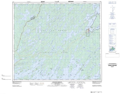
073P07 Stanley Mission Canada topo map, 1:50,000 scale
073P07 Stanley Mission NRCAN topographic map.
Includes UTM and GPS geographic coordinates (latitude and longitude). This 50k scale map is suitable for hiking, camping, and exploring, or you could frame it as a wall map.
Printed on-demand using high resolution, on heavy weight and acid free paper, or as an upgrade on a variety of synthetic materials.
Topos available on paper, Waterproof, Poly, or Tyvek. Usually shipping rolled, unless combined with other folded maps in one order.
- Product Number: NRCAN-073P07
- Parent Topo: TOPO-073P
- Map ID also known as: 073P07, 73P7, 73P07
- Unfolded Size: Approximately 26" high by 36" wide
- Weight (paper map): ca. 55 grams
- Map Type: POD NRCAN Topographic Map
- Map Scale: 1:50,000
- Geographical region: Saskatchewan, Canada
Neighboring Maps:
All neighboring Canadian topo maps are available for sale online at 1:50,000 scale.
Purchase the smaller scale map covering this area: Topo-073P
Spatial coverage:
Topo map sheet 073P07 Stanley Mission covers the following places:
- Arrowhead Bay - Bradshaw Bay - Campbell Bay - Chapman Bay - Chepakan Bay - Churchill River Bay - Cochrane Bay - Cuelenaere Bay - Diefenbaker Bay - Four Portages Bay - Harvesting Bay - Heyer Bay - Lovell Bay - Neufeld Bay - Ore Bay - Pipestone Bay - Pothole Bay - Russell Bay - Sauter Bay - Smith Bay - Staples Bay - Stewart Young Bay - Thomas Bay - Toland Bay - Urton Bay - Wadin Bay - Bonanza Point - Burton Peninsula - Duck Point - Ferguson Point - Johnston Peninsula - Ledingham Peninsula - MacLean Peninsula - Mitchell Peninsula - Patterson Peninsula - Swanston Point - Uranium Point - Young Peninsula - Amuchewaspimewin Cliff - Stanley Mission - Four Portages 157C - Old Fort 157B - Stanley 157 - Aronson Island - Bear Island - Bereskin Island - Blanchard Island - Boyd Island - Braaten Island - Dot Island - End Island - Fairhead Island - Feldman Island - Foster Island - Fuller Island - Gilchrist Island - Glenn Island - Harman Island - Hillis Island - Howlett Island - Karcza Island - Keller Island - Kenderdine Island - Kubian Island - Lamb Island - Lunch Island - Marg Island - McCannel Island - Mullen Islands - Rhind Island - Rhoda Island - Rubin Island - Seaker Island - Spencer Island - Starfield Island - Swanson Island - Tingey Island - Toland Island - Warne Island - Worden Island - Aikenhead Lakes - Bagshaw Lakes - Baldhead Lake - Bartlett Lake - Bell Lake - Bon Seigneur Lake - Bow Lake - Bradshaw Lake - Bulbick Lake - Cairns Lake - Caribou Lake - Coady Lake - Contact Lake - Cote Lake - Dingwall Lake - Duck Lake - Fault Lake - Fisher Lake - Five Fingers Lake - Freda Lake - Freestone Lake - Gross Lake - Hale Lake - Harlton Lake - Hay Lake - Hebden Lake - Hunt Lake - Jepson Lakes - Johnston Lake - Kuskawao Lake - Lac la Ronge - Land Lake - Leckie Lake - Linton Lake - Little Deer Lake - Little Lake - Loving Lake - Lynx Lake - MacKay Lake - Mahon Lake - Maloney Lake - McCaffrey Lake - McDonell Lake - McNichol Lake - Mekewap Lake - Moore Lake - Mosquito Lake - Mossing Lake - Mountain Lake - Muledeer Lake - Mullock Lake - Naniskak Lakes - Needle Lake - Nesbitt Lake - Otter Lake - Pechey Lake - Poulton Lake - Preview Lake - Ramsland Lakes - Richardson Lake - Richter Lake - Ritchie Lake - Scramsted Lakes - Scythes Lake - Shoemaker Lake - Sim Lake - Stroud Lake - Sulphide Lake - Sutherland Lake - Switzer Lake - Telfer Lake - Teneycke Lake - Turtle Lake - Upises Lake - Warnock Lake - Welk Lake - West Lake - Westroud Lake - Zunti Lake - Holy Trinity Anglican Church/Stanley Mission Historic Site - Lac la Ronge Park - Lac La Ronge Provincial Park - MacKay Lake Recreation Site - Churchill River - Lynx River - Rivière Churchill - Robertson Creek - Thomas Creek - First Portage - Hartwell


