
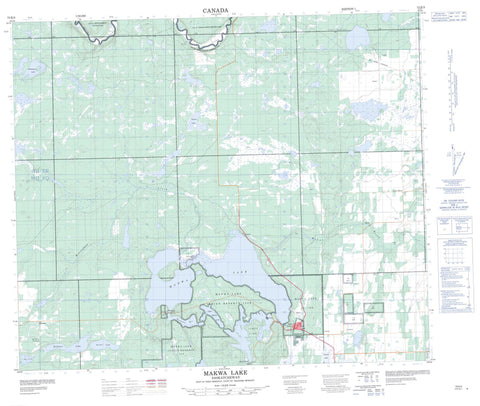
073K03 Makwa Lake Canada topo map, 1:50,000 scale
073K03 Makwa Lake NRCAN topographic map.
Includes UTM and GPS geographic coordinates (latitude and longitude). This 50k scale map is suitable for hiking, camping, and exploring, or you could frame it as a wall map.
Printed on-demand using high resolution, on heavy weight and acid free paper, or as an upgrade on a variety of synthetic materials.
Topos available on paper, Waterproof, Poly, or Tyvek. Usually shipping rolled, unless combined with other folded maps in one order.
- Product Number: NRCAN-073K03
- Parent Topo: TOPO-073K
- Map ID also known as: 073K03, 73K3, 73K03
- Unfolded Size: Approximately 26" high by 36" wide
- Weight (paper map): ca. 55 grams
- Map Type: POD NRCAN Topographic Map
- Map Scale: 1:50,000
- Geographical region: Saskatchewan, Canada
Neighboring Maps:
All neighboring Canadian topo maps are available for sale online at 1:50,000 scale.
Purchase the smaller scale map covering this area: Topo-073K
Spatial coverage:
Topo map sheet 073K03 Makwa Lake covers the following places:
- Sanderson Bay - Mewasin Beach - Steele Narrows - Makwa Lake 129 - Makwa Lake 129A - Makwa Lake 129B - Makwa Lake 129C - Thunderchild First Nation 115M - Thunderchild First Nation 115R - Thunderchild First Nation 115S - Thunderchild First Nation 115T - Thunderchild First Nation 115Z - Boa Lake - Fowler Lake - Jumbo Lake - Long Lake - Makwa Lake - Murphy Lake - Nichols Lake - Upper Makwa Lake - Watson Lake - Whitehood Lake - Beaver River No. 622 - Loon Lake No. 561 - Meadow Lake No. 588 - Fowler Lake Recreation Site - Makwa Lake Provincial Park - Makwa Lake Provincial Recreation Site - Steele Narrows Provincial Park - Beaver River - Horsehead Creek - Makwa River - Ministikwan Creek - Blue Bell - Loon River - Pine Cove - Whelan - Loon Lake


