
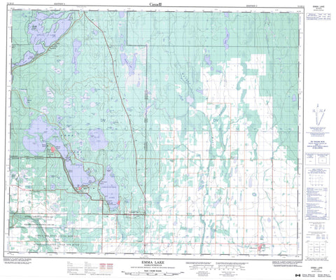
073H12 Emma Lake Canada topo map, 1:50,000 scale
073H12 Emma Lake NRCAN topographic map.
Includes UTM and GPS geographic coordinates (latitude and longitude). This 50k scale map is suitable for hiking, camping, and exploring, or you could frame it as a wall map.
Printed on-demand using high resolution, on heavy weight and acid free paper, or as an upgrade on a variety of synthetic materials.
Topos available on paper, Waterproof, Poly, or Tyvek. Usually shipping rolled, unless combined with other folded maps in one order.
- Product Number: NRCAN-073H12
- Parent Topo: TOPO-073H
- Map ID also known as: 073H12, 73H12
- Unfolded Size: Approximately 26" high by 36" wide
- Weight (paper map): ca. 55 grams
- Map Type: POD NRCAN Topographic Map
- Map Scale: 1:50,000
- Geographical region: Saskatchewan, Canada
Neighboring Maps:
All neighboring Canadian topo maps are available for sale online at 1:50,000 scale.
Purchase the smaller scale map covering this area: Topo-073H
Spatial coverage:
Topo map sheet 073H12 Emma Lake covers the following places:
- Christie Bay - Doyle Bay - Jacobsen Bay - Munsons Bay - North Bay - Pope Bay - Slottens Bay - Sunset Bay - Buffalo Point - Lindner Point - McIntosh Point - Murray Point - Nyberg Point - Spruce Point - Northside - Little Red River 106C - Callaghan Island - Campbell Island - Cattle Island - Fairy Island - Anderson Lake - Anglin Lake - Bauman Lake - Begon Lake - Blanche Lake - Carruthers Lake - Cecile Lake - Christie Lake - Christopher Lake - Clarine Lake - Courtney Lake - Dewalt Lake - DeWalt Lake - Discovery Lake - Dorine Lake - Emma Lake - Ethel Lake - Fish Camp Lake - Fish Lake - Gladys Lake - Haase Lake - Hiltz Lake - Hourie Lake - Huntley Lake - Irving Lake - Jean Lake - Josie Lake - Last Trap Lake - Laura Lake - Lennox Lake - Mae Lake - Marguerite Lake - Marshall Lake - Middle Elk Lake - Mitz Lake - Muskeg Lake - Nelson Lake - Nora Lake - North Elk Lake - Olga Lake - Oscar Lake - Patsy Lake - Phyllis Lake - Rebitt Lake - Ross Lake - Sampson Lake - South Elk Lake - Temple Lake - Tina Lake - Lakeland No. 521 - Paddockwood No. 520 - Anglin Lake Recreation Site - Emma Lake (Murray Point) Recreation Site - Fairy Island Wildlife Refuge - Northern Provincial Forest - Bitter Creek - Christopher Creek - Garden River - Montreal Creek - Rebitt Creek - Spruce River - Anglin Lake - Clearsand Beach - Emma Lake - Forest Gate - Guises Beach - McPhail Cove - Murray Point - Nies Beach - Okema Beach - Sunnyside Beach - Tweedsmuir - Christopher Lake - Paddockwood


