
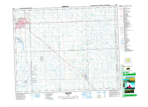
062M01 Yorkton Canada topo map, 1:50,000 scale
062M01 Yorkton NRCAN topographic map.
Includes UTM and GPS geographic coordinates (latitude and longitude). This 50k scale map is suitable for hiking, camping, and exploring, or you could frame it as a wall map.
Printed on-demand using high resolution, on heavy weight and acid free paper, or as an upgrade on a variety of synthetic materials.
Topos available on paper, Waterproof, Poly, or Tyvek. Usually shipping rolled, unless combined with other folded maps in one order.
- Product Number: NRCAN-062M01
- Parent Topo: TOPO-062M
- Map ID also known as: 062M01, 62M1, 62M01
- Unfolded Size: Approximately 26" high by 36" wide
- Weight (paper map): ca. 55 grams
- Map Type: POD NRCAN Topographic Map
- Map Scale: 1:50,000
- Geographical region: Saskatchewan, Canada
Neighboring Maps:
All neighboring Canadian topo maps are available for sale online at 1:50,000 scale.
Purchase the smaller scale map covering this area: Topo-062M
Spatial coverage:
Topo map sheet 062M01 Yorkton covers the following places:
- Logan Bay - Yorkton - Kahkewistahaw 72 A-1 - Keeseekoose 66-Sa-01 - Keeseekoose 66-Sa-02 - Little Bone 74B - Little Bone Indian Reserve 73A - Minoahchak 74C - Minoahchak Indian Reserve 230 - Réserve indienne Little Bone 73A - Réserve indienne Minoahchak 230 - Sakimay 74-1 - Sakimay 74-3 - Sakimay 74-7 - Adams Lake - Anderson Lake - Armstrong Lake - Crescent Lake - Kirkham Lake - Leech Lake - Potts Lake - Soda Lake - York Lake - Calder No. 241 - Cana No. 214 - Churchbridge No. 211 - Orkney No. 244 - Saltcoats No. 213 - Wallace No. 243 - Saltcoats Game Preserve - Saltcoats Regional Park - York Lake Regional Park - Crescent Creek - Wallace Creek - Yorkton Creek - Saltcoats - Barbour - Barvas - Calley - Chrysler - Clonmel - Dunleath - Kessock - Rokeby - Sturdee - Tonkin


