
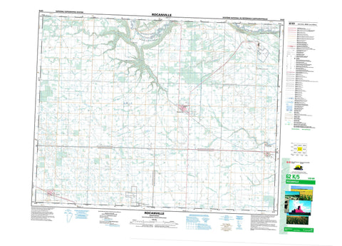
062K05 Rocanville Canada topo map, 1:50,000 scale
062K05 Rocanville NRCAN topographic map.
Includes UTM and GPS geographic coordinates (latitude and longitude). This 50k scale map is suitable for hiking, camping, and exploring, or you could frame it as a wall map.
Printed on-demand using high resolution, on heavy weight and acid free paper, or as an upgrade on a variety of synthetic materials.
Topos available on paper, Waterproof, Poly, or Tyvek. Usually shipping rolled, unless combined with other folded maps in one order.
- Product Number: NRCAN-062K05
- Parent Topo: TOPO-062K
- Map ID also known as: 062K05, 62K5, 62K05
- Unfolded Size: Approximately 26" high by 36" wide
- Weight (paper map): ca. 55 grams
- Map Type: POD NRCAN Topographic Map
- Map Scale: 1:50,000
- Geographical region: Saskatchewan, Canada
Neighboring Maps:
All neighboring Canadian topo maps are available for sale online at 1:50,000 scale.
Purchase the smaller scale map covering this area: Topo-062K
Spatial coverage:
Topo map sheet 062K05 Rocanville covers the following places:
- Ochapowace 71-12 - Ochapowace 71-26 - Barish Lake - Martin No. 122 - Moosomin No. 121 - Rocanville No. 151 - Spy Hill No. 152 - Fort Espérance National Historic Site of Canada - Lieu historique national du Canada du Fort-Espérance - Welwyn Centennial Regional Park - Widdess-Arnold Provincial Historic Site - Beaver Creek - Qu'Appelle River - Scissor Creek - Scissors Creek - Rocanville - Wapella - Bear Creek - Ste-Marthe-Rocanville - Logan Coulee - Welwyn


