
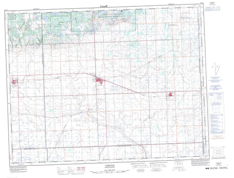
062E09 Carlyle Canada topo map, 1:50,000 scale
062E09 Carlyle NRCAN topographic map.
Includes UTM and GPS geographic coordinates (latitude and longitude). This 50k scale map is suitable for hiking, camping, and exploring, or you could frame it as a wall map.
Printed on-demand using high resolution, on heavy weight and acid free paper, or as an upgrade on a variety of synthetic materials.
Topos available on paper, Waterproof, Poly, or Tyvek. Usually shipping rolled, unless combined with other folded maps in one order.
- Product Number: NRCAN-062E09
- Parent Topo: TOPO-062E
- Map ID also known as: 062E09, 62E9, 62E09
- Unfolded Size: Approximately 26" high by 36" wide
- Weight (paper map): ca. 55 grams
- Map Type: POD NRCAN Topographic Map
- Map Scale: 1:50,000
- Geographical region: Saskatchewan, Canada
Neighboring Maps:
All neighboring Canadian topo maps are available for sale online at 1:50,000 scale.
Purchase the smaller scale map covering this area: Topo-062E
Spatial coverage:
Topo map sheet 062E09 Carlyle covers the following places:
- Adrian Lake - Big Marsh Lake - Black Lake - Ess Lake - Hoppertown Lake - Kippan Lake - Little Chain Lake - McGurk Lake - Munns Lake - Peacard Lake - Stevenson Lake - White Lake - Heart Hill - Moose Mountain - Antler No. 61 - Brock No. 64 - Browning No. 34 - Moose Creek No. 33 - Moose Mountain No. 63 - Reciprocity No. 32 - Walpole No. 92 - Cannington Manor Provincial Park - Moose Mountain Provincial Forest - Moose Mountain Provincial Park - Auburnton Creek - Cowper Creek - Crooked Creek - Moose Mountain Creek - Morrison Creek - Swift Creek - Smiley Springs - Arcola - Carlyle - Cowper - Fremantle - Service - Steppes - Wordsworth - Camerons Slough - Manor


