
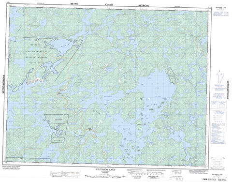
052L02 Whitedog Lake Canada topo map, 1:50,000 scale
052L02 Whitedog Lake NRCAN topographic map.
Includes UTM and GPS geographic coordinates (latitude and longitude). This 50k scale map is suitable for hiking, camping, and exploring, or you could frame it as a wall map.
Printed on-demand using high resolution, on heavy weight and acid free paper, or as an upgrade on a variety of synthetic materials.
Topos available on paper, Waterproof, Poly, or Tyvek. Usually shipping rolled, unless combined with other folded maps in one order.
- Product Number: NRCAN-052L02
- Parent Topo: TOPO-052L
- Map ID also known as: 052L02, 52L2, 52L02
- Unfolded Size: Approximately 26" high by 36" wide
- Weight (paper map): ca. 55 grams
- Map Type: POD NRCAN Topographic Map
- Map Scale: 1:50,000
- Geographical region: Ontario, Canada
Neighboring Maps:
All neighboring Canadian topo maps are available for sale online at 1:50,000 scale.
Purchase the smaller scale map covering this area: Topo-052L
Spatial coverage:
Topo map sheet 052L02 Whitedog Lake covers the following places:
- Billings Bay - Duck Bay - Ellis' Bay - Finger Bay - Lost Bay - Milner's Bay - Mine Bay - Moose Bay - Outlet Bay - Scot Bay - Vermilion Bay - West Bay - Martin's Beach - Baker's Point - Hatrack Point - Moore's Point - The Peninsula - Wohlwend's Point - Pistol Lake Narrows - Roughrock Narrows - The North Channel - Gooseneck Cliffs - Rudd - Islington 29 - Islington Indian Reserve 29 - Réserve indienne Islington 29 - Réserve indienne Swan Lake 29 - Swan Lake 29 - Swan Lake Indian Reserve 29 - Wabaseemoong 29 - Bower's Island - Burnt Island - Castle's Island - Chapman's Island - Clark's Island - Cummings Island - Dead Boys Island - Deer Island - Green Island - Gull Island - Harbour Island - Indian Island - Octo Island - Olsen's Island - P.E.I. - Parker's Island - Pickerel Island - Pine Island - Raspberry Island - Sellers Island - The Elephant's Hump - The Sugarloaf - The Twin Islands - Vermilion Island - Whiskey Island - Whitedog Island - Wilcox Island - Alexander Lake - Bakado Lake - Bass Lake - Bays Lake - Beaver Lake - Big Sand Lake - Blueberry Lake - Conte Lake - Cygnet Lake - Dummy Lake - Ena Lake - First Lake - Fourth Lake - Gib Lake - Gone Lake - Gooseneck Lake - Goshawk Lake - Hidden Lake - High Lake - India Lake - Little Sand Lake - Lost Lake - Moose Lake - Muskeg Narrows Lake - Musky Narrows Lake - Namego Lake - Oneman Lake - Perch Lake - Pig Lake - Pistol Lake - Portage Lake - Pothole Lake - Road Lake - Roughrock Lake - Sand Lake - Sand Lake - Second Lake - Sixth Lake - Snook Lake - Sum Lake - Swan Lake - Sword Lake - Tetu Lake - Third Lake - Tourist Lake - Trout Lake - Turtle Lake - Twelnor Lake - Umfreville Lake - Umfreville Lake - Vermilion Lake - Whitedog Lake - Worth Lake - Zodiac Lakes - Big Sand Lake Conservation Reserve - English River - Fox Creek - Namego Creek - Rivière Winnipeg - Sum Creek - Sword Creek - Turtle Creek - Whitedog River - Winnipeg River - Zodiac Creek - Black Bear Portage - Rockpile - Windigo Rock - Whitedog


