
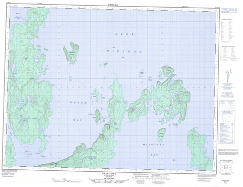
052H10 Grand Bay Canada topo map, 1:50,000 scale
052H10 Grand Bay NRCAN topographic map.
Includes UTM and GPS geographic coordinates (latitude and longitude). This 50k scale map is suitable for hiking, camping, and exploring, or you could frame it as a wall map.
Printed on-demand using high resolution, on heavy weight and acid free paper, or as an upgrade on a variety of synthetic materials.
Topos available on paper, Waterproof, Poly, or Tyvek. Usually shipping rolled, unless combined with other folded maps in one order.
- Product Number: NRCAN-052H10
- Parent Topo: TOPO-052H
- Map ID also known as: 052H10, 52H10
- Unfolded Size: Approximately 26" high by 36" wide
- Weight (paper map): ca. 55 grams
- Map Type: POD NRCAN Topographic Map
- Map Scale: 1:50,000
- Geographical region: Ontario, Canada
Neighboring Maps:
All neighboring Canadian topo maps are available for sale online at 1:50,000 scale.
Purchase the smaller scale map covering this area: Topo-052H
Spatial coverage:
Topo map sheet 052H10 Grand Bay covers the following places:
- Black Sturgeon Bay - CaribouHarbour - Charlie's Harbour - Chief Bay - Grand Bay - Gull Bay - Hummingbird Harbour - Kaiashk Bay - Lynx Harbour - McIntyre Bay - Two Mountain Harbour - Burnt Point - Dead Poplar Point - Furness Point - Grand Cape - Gros Cap - Ingall Point - Keezis Point - Smoke Point - Spruce Point - Tchiatang Point - Gros Cap Channel - Tchiatang Bluff - Thunder Bay - Astrand Island - Bond Island - Booth Island - Brown Island - Caribou Island - Fairey Island - Gneiss Island - Lamont Island - Lynx Island - McIntyre Island - McKinnon Islands - Penkuri Island - Pipewrench Island - Pretty Island - St. Paul Island - Trunk Island - Two Mountain Island - Ursel Islands - Bodner Lake - Foote Lake - Hunt Lake - Lac Nipigon - Lake Nipigon - Lehtinen Lake - Little McKessock Lake - Lonely Lake - Maki Lake - Mara Lake - McKessock Lake - Oribine Lake - Tunney Lake - McKessock Creek - Wilgar Creek - Wolf Creek - Boggy Portage - Two Mountain Portage


