
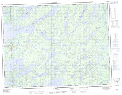
052G15 Glitter Lake Canada topo map, 1:50,000 scale
052G15 Glitter Lake NRCAN topographic map.
Includes UTM and GPS geographic coordinates (latitude and longitude). This 50k scale map is suitable for hiking, camping, and exploring, or you could frame it as a wall map.
Printed on-demand using high resolution, on heavy weight and acid free paper, or as an upgrade on a variety of synthetic materials.
Topos available on paper, Waterproof, Poly, or Tyvek. Usually shipping rolled, unless combined with other folded maps in one order.
- Product Number: NRCAN-052G15
- Parent Topo: TOPO-052G
- Map ID also known as: 052G15, 52G15
- Unfolded Size: Approximately 26" high by 36" wide
- Weight (paper map): ca. 55 grams
- Map Type: POD NRCAN Topographic Map
- Map Scale: 1:50,000
- Geographical region: Ontario, Canada
Neighboring Maps:
All neighboring Canadian topo maps are available for sale online at 1:50,000 scale.
Purchase the smaller scale map covering this area: Topo-052G
Spatial coverage:
Topo map sheet 052G15 Glitter Lake covers the following places:
- Cobb Bay - LeBeau Bay - Moose Bay - Sturgeon Narrows - Thunder Bay - Narrows Island - Seaton Island - Add Lake - Anderson Lake - Barge Lake - Bell Lake - Bing Lake - Blackbird Lake - Byline Lake - Cedarclump Lake - Chickadee Lake - Claw Lake - Cutstone Lake - Darkwater Lake - Div Lake - Dunne Lake - Empress Lake - Glitter Lake - Goodman Lake - Gridiron Lake - Hearst Lake - Hump Lake - Jagged Lake - Karen Lake - King Lake - Longneck Lake - Lyon Lake - North Rocker Lake - Post Lake - Princess Lake - Queer Lake - Quest Lake - Quiet Lake - Quill Lake - Redbreast Lake - Redwing Lake - Rocker Lake - Sassafras Lake - Saunders Lake - Seseganaga Lake - Shaw Lake - Shikag Lake - Six Mile Lake - Sixmile Lake - Spot Lake - Sprucecone Lake - St. Mary Lake - Sturgeon Lake - Swamp Lake - Telephone Lake - Tokay Lake - Vista Lake - Wattle Lake - Willet Lake - Willow Lake - Willow Lake Conservation Reserve - Agimac River - Bell Creek - Bing Creek - Claw Creek - Dan's Creek - Div Creek - Empress Creek - Glitter Creek - Post Creek - Quest Creek - Quiet Creek - Rocker Creek - Shaw Creek - Shikag River - Six Mile Creek - Spot Creek - St. Mary Creek - Tokay Creek


