
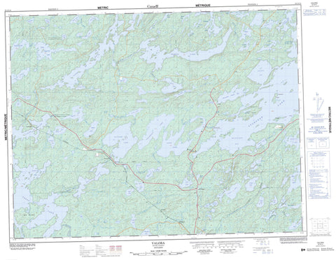
052G14 Valora Canada topo map, 1:50,000 scale
052G14 Valora NRCAN topographic map.
Includes UTM and GPS geographic coordinates (latitude and longitude). This 50k scale map is suitable for hiking, camping, and exploring, or you could frame it as a wall map.
Printed on-demand using high resolution, on heavy weight and acid free paper, or as an upgrade on a variety of synthetic materials.
Topos available on paper, Waterproof, Poly, or Tyvek. Usually shipping rolled, unless combined with other folded maps in one order.
- Product Number: NRCAN-052G14
- Parent Topo: TOPO-052G
- Map ID also known as: 052G14, 52G14
- Unfolded Size: Approximately 26" high by 36" wide
- Weight (paper map): ca. 55 grams
- Map Type: POD NRCAN Topographic Map
- Map Scale: 1:50,000
- Geographical region: Ontario, Canada
Neighboring Maps:
All neighboring Canadian topo maps are available for sale online at 1:50,000 scale.
Purchase the smaller scale map covering this area: Topo-052G
Spatial coverage:
Topo map sheet 052G14 Valora covers the following places:
- Anderson's Bay - Beidelman Bay - Cobb Bay - Granite Bay - Mountain Island Bay - Peterson Cove - Sac Bay - Big Narrows - Barrett - Factor - Slaght - Big Island - Big Island - Fisherman's Island - Ghost Island - Mountain Island - Portage Island - Basin Lake - Bell Lake - Bob Lake - Boundary Lake - Bullseye Lake - Capee Lake - Cluster Lakes - Cobb Lake - Cocoa Lake - Crescent Lake - Darkwater Lake - Divided Lake - Drop Lake - Dry Lake - Ellipse Lake - Elva Lake - Ethlouise Lake - Fine Lake - Frog Pond - Gary Lake - Graystone Lake - Harvey Lake - Hideaway Lake - Hut Lake - Jackpot Lake - Jarvis Lake - Jigger Lake - Kena Lake - Lake of Bays - Landlock Lake - Marcelle Lake - McKee Lake - McLeod Lake - Misery Lake - Moss Lake - Mountain Island Lake - Mulligan Lake - Nak Lake - Net Lake - Niemi Lake - Norm Lake - Omega Lake - Outlet Lake - Pear Lake - Penassi Lake - Pepperbell Lake - Pike Lake - Press Lake - Prospect Lake - Quaint Lake - Rice Pond - Running Deer Lake - Shanty Lake - Shiny Lake - Stake Lake - Steve Lake - Stevedore Lake - Sturgeon Lake - Sucker Lake - Surprise Lake - Tea Lake - Towers Lake - Trade Lake - Upper Pepperbell Lake - Valora Lake - Voodoo Lake - Watcomb Lake - Whiterock Lake - Wintering Lake - Wish Lake - Wonder Lake - Wyatt Lake - Yonde Lake - Young Lake - East English River Provincial Park - Bays River - Cluster Creek - Darkwater Creek - Dominion Creek - Dominion River - Elbow Creek - Ellipse Creek - English River - Grassy River - Moss Creek - Niemi Creek - Pear Creek - Pepperbell Creek - Shanty Creek - Shiny Creek - Stake Creek - Towers Creek - Trade Creek - Trout Creek - Wintering River - Clarkdon - O'Briens Landing - Silver Dollar - Umfreville - Valora - Wako - Watcomb


