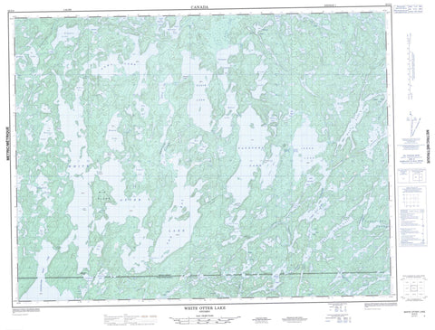
052G04 White Otter Lake Canada topo map, 1:50,000 scale
052G04 White Otter Lake NRCAN topographic map.
Includes UTM and GPS geographic coordinates (latitude and longitude). This 50k scale map is suitable for hiking, camping, and exploring, or you could frame it as a wall map.
Printed on-demand using high resolution, on heavy weight and acid free paper, or as an upgrade on a variety of synthetic materials.
Topos available on paper, Waterproof, Poly, or Tyvek. Usually shipping rolled, unless combined with other folded maps in one order.
- Product Number: NRCAN-052G04
- Parent Topo: TOPO-052G
- Map ID also known as: 052G04, 52G4, 52G04
- Unfolded Size: Approximately 26" high by 36" wide
- Weight (paper map): ca. 55 grams
- Map Type: POD NRCAN Topographic Map
- Map Scale: 1:50,000
- Geographical region: Ontario, Canada
Neighboring Maps:
All neighboring Canadian topo maps are available for sale online at 1:50,000 scale.
Purchase the smaller scale map covering this area: Topo-052G
Spatial coverage:
Topo map sheet 052G04 White Otter Lake covers the following places:
- Ann Bay - Camp Bay - Garbage Bay - Irene Bay - Lost Bay - McOuat Bay - Pike Bay - Sucker Bay - Walleye Bay - Jackfish Narrows - Rainy River - Big Island - Eddie's Island - Graveyard Island - Gull Island - Mallard Island - Myers Islands - Barr Lake - Below Bow Lake - Bentarm Lake - Big Island Lake - Bow Lake - Campus Lake - Clearwater West Lake - Cole Lake - Crowrock Lake - Dibble Lake - Dimple Lake - Doan Lake - East Campus Lake - Elsie Lake - Emery Lake - Fish Lake - Gamble Lake - Halfmoon Lake - Hawknest Lake - Herb Lake - Heuston Lake - Highland Lake - Hoolighan Lake - Hoolihan Lake - Irene Lake - Jac Saga Lake - Jackfish Lake - Johnson Lake - Kingfish Lake - Lac La Mere - Lautons Lake - Little Gull Lake - Little Irene Lake - Little Mabel Lake - Little Sandford Lake - Lower Moosehide Lake - Mabel Lake - Mae Lake - Moosehide Lake - Nora Lake - Owl Lake - Patricia Lake - Potts Lake - Rollingstone Lake - Sandford Lake - Serpent Lake - South Gull Lake - Upper Doan Lake - Upper Moosehide Lake - Walt Lake - Wasp Lake - White Otter Lake - Campus Lake Conservation Reserve - Turtle River Provincial Park - Turtle River-White Otter Lake Provincial Park - White Otter Lake Wilderness Area - Balmoral River - Campus Creek - East Campus Creek - Emery Creek - Gamble River - Highland Creek - Little Turtle River - Nora Creek - Owl Creek - Ann Bay Portage - Clearwater Portage - Hawknest Portage - Heuston Portage - Irene Portage - Nora Portage - Wasp Lake Portage - Froggie's Rock


