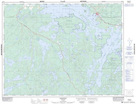
052F10 Wabigoon Canada topo map, 1:50,000 scale
052F10 Wabigoon NRCAN topographic map.
Includes UTM and GPS geographic coordinates (latitude and longitude). This 50k scale map is suitable for hiking, camping, and exploring, or you could frame it as a wall map.
Printed on-demand using high resolution, on heavy weight and acid free paper, or as an upgrade on a variety of synthetic materials.
Topos available on paper, Waterproof, Poly, or Tyvek. Usually shipping rolled, unless combined with other folded maps in one order.
- Product Number: NRCAN-052F10
- Parent Topo: TOPO-052F
- Map ID also known as: 052F10, 52F10
- Unfolded Size: Approximately 26" high by 36" wide
- Weight (paper map): ca. 55 grams
- Map Type: POD NRCAN Topographic Map
- Map Scale: 1:50,000
- Geographical region: Ontario, Canada
Neighboring Maps:
All neighboring Canadian topo maps are available for sale online at 1:50,000 scale.
Purchase the smaller scale map covering this area: Topo-052F
Spatial coverage:
Topo map sheet 052F10 Wabigoon covers the following places:
- Barrit Bay - Contact Bay - Daunais Bay - Kagiwiosa Bay - Kaminnassin Bay - Kelpyn Bay - Larson Bay - Moose Bay - Mud Bay - Muskie Bay - Niven Bay - Olsen Bay - Osbourne Bay - Peg Leg Joe's Bay - Stanawan Bay - Whitefish Bay - Wildcat Bay - Alto's Point - Bowen Point - Bruce Point - McGraw's Point - Soapstone Point - Brûlé Narrows - The Canal - The Narrows - Whiteclay Narrows - Dryden - Ingall Falls - Aubrey - Hartman - Satterly - Southworth - Van Horne - Zealand - Réserve indienne Wabigoon Lake 27 - Wabigoon Lake 27 - Wabigoon Lake Indian Reserve 27 - Anderson Island - Christie's Island - Copeland Island - Devil's Island - Dog Island - Fox Island - Graveyard Island - Green Island - Grenville Island - Powder Island - Wheeler's Island - Alston Lake - Bennett Lake - Bob Lake - Burr Lake - Butler Lake - Dinorwic Lake - Doré Lake - Eagle Lake - East Godson Lake - Emmons Lake - Flambeau Lake - Gladys Lake - Godson Lake - Guy Lake - Humphrey Lake - Ingall Lake - Kekekwa Lake - Larson Lake - Lavo Lake - Lost Lake - Marilyn Lake - Mary Lake - Maryjo Lake - Mile Lake - Minnehaha Lake - Nabish Lake - Oley Lake - Olsen Lake - Orchid Lake - Paulson Lake - Peak Lake - Pickerel Lake - Pitt Lake - Prig Lake - Pritchard Lake - Rock Lake - Snowfall Lake - Stuart Lake - Tobacco Lake - Trap Lake - Tremeer Lake - Turtlepond Lake - Twingrass Lakes - Ukik Lake - Wabigoon Lake - Watt Lake - Whitewater Lake - Barclay - Butler Lake Provincial Nature Reserve - The Rapids - Wawapus Falls - Blackburn Creek - Blackwater Creek - Burr Creek - Crooked River - Godson Creek - Hughes Brook - Hughes Brook - Hughes Creek - Kekekwa Creek - McHugh Creek - McKenzie Creek - McLeod's Creek - Nugget Creek - Pichenninnis Brook - Pitchinese Creek - Rice River - Threefork Creek - Threefork River - Thunder Creek - Thunder River - Tobacco Creek - Ukik Creek - Wabigoon River - Wawapus Creek - Dinorwic - Wabigoon


