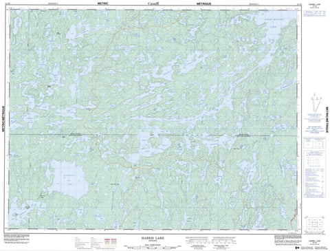
052F03 Harris Lake Canada topo map, 1:50,000 scale
052F03 Harris Lake NRCAN topographic map.
Includes UTM and GPS geographic coordinates (latitude and longitude). This 50k scale map is suitable for hiking, camping, and exploring, or you could frame it as a wall map.
Printed on-demand using high resolution, on heavy weight and acid free paper, or as an upgrade on a variety of synthetic materials.
Topos available on paper, Waterproof, Poly, or Tyvek. Usually shipping rolled, unless combined with other folded maps in one order.
- Product Number: NRCAN-052F03
- Parent Topo: TOPO-052F
- Map ID also known as: 052F03, 52F3, 52F03
- Unfolded Size: Approximately 26" high by 36" wide
- Weight (paper map): ca. 55 grams
- Map Type: POD NRCAN Topographic Map
- Map Scale: 1:50,000
- Geographical region: Ontario, Canada
Neighboring Maps:
All neighboring Canadian topo maps are available for sale online at 1:50,000 scale.
Purchase the smaller scale map covering this area: Topo-052F
Spatial coverage:
Topo map sheet 052F03 Harris Lake covers the following places:
- Adams Bay - Canoe Bay - Furlonge Bay - Hidden Bay - Indian Bay - James Bay - Line Bay - Mirror Bay - Peep Bay - Smoke Bay - Snare Bay - South Bay - Steamboat Bay - Thompson Bay - Famine Point - McDonald Point - Cedar Narrows - Muskeg Narrows - Birch Island - Hemlock Island - Allen Lake - Alonghill Lake - Asheigamo Lake - Baldwin Lake - Bartley Lake - Bat Lake - Bend Lake - Bivouac Lake - Bluffpoint Lake - Bretz Lake - Calder Lake - Caterpillar Lake - Cross Lake - Crossroute Lake - Davis Lake - Dogfly Lake - Edward Lake - Eric Lake - Esox Lake - Eyelid Lake - Fahey Lake - Flossie Lake - Floyd Lake - Fog Lake - Furlonge Lake - Gates Lake - George Lake - Grant Lake - Grave Lake - Gussie Lake - Harris Lake - Hill Lake - Holstein Lake - Hook Lake - Hutchins Lake - James Lake - Kahabeness Lake - Kaiarskons Lake - Kaiashkons Lake - Konigson Lake - Lawrence Lake - Long Grass Lake - Loonhaunt Lake - Lou Lake - Lower Furlonge Lake - Lower Manitou Lake - Missus Lake - Mister Lake - Moose Lake - Muskeg Lake - Napanee Lake - Neilson Lake - Obin Lake - Phairs Lake - Pickwick Lake - Pipestone Lake - Pontoon Lake - Prince Lake - Respite Lake - Route Lake - Seahorse Lake - Sitting Moose Lake - Smoulder Lake - Sphene Lake - Straw Lake - Sucan Lake - Sullivan Lake - Syndicate Lake - Three Island Lake - Toronto Lake - Twist Lake - Upper Lawrence Lake - Van Lake - Vedette Lake - Vickers Lake - Vista Lake - Whalen Lake - Wilson Lake - Yoke Lake - Manitou Conservation Reserve - Big Canoe River - Bluffpoint Creek - Crossroute Creek - Hook Creek - Kaiashkons Creek - Konigson Creek - Little Canoe Creek - Little Canoe River - Loonhaunt River - Manitou River - Mister Creek - Pipestone Creek - Seahorse Creek - Straw Creek - Straw Creek - Straw Creek - Sucan Creek - Manitou Stretch - Dogfly Portage - Kaiashkons Portage - Rocky Portage - Sucan Portage - Sullivan Portage


