
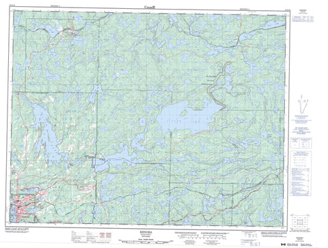
052E16 Kenora Canada topo map, 1:50,000 scale
052E16 Kenora NRCAN topographic map.
Includes UTM and GPS geographic coordinates (latitude and longitude). This 50k scale map is suitable for hiking, camping, and exploring, or you could frame it as a wall map.
Printed on-demand using high resolution, on heavy weight and acid free paper, or as an upgrade on a variety of synthetic materials.
Topos available on paper, Waterproof, Poly, or Tyvek. Usually shipping rolled, unless combined with other folded maps in one order.
- Product Number: NRCAN-052E16
- Parent Topo: TOPO-052E
- Map ID also known as: 052E16, 52E16
- Unfolded Size: Approximately 26" high by 36" wide
- Weight (paper map): ca. 55 grams
- Map Type: POD NRCAN Topographic Map
- Map Scale: 1:50,000
- Geographical region: Ontario, Canada
Neighboring Maps:
All neighboring Canadian topo maps are available for sale online at 1:50,000 scale.
Purchase the smaller scale map covering this area: Topo-052E
Spatial coverage:
Topo map sheet 052E16 Kenora covers the following places:
- Crystal Bay - Golf Course Bay - Greens Bay - Kenora Bay - Long Tent Bay - North East Bay - Rat Portage Bay - Rice Bay - Rideout Bay - Bennetto Point - Camerons Point - Logans Point - Pophams Point - Camerons Narrows - First Rapids Narrows - Grassy Narrows - Kenora - Coyle - Desmond - Haycock - Jackman - Jaffray - MacNicol - Melick - Pettypiece - Redditt - Norman Dam - Bush Island - Coney Island - Ile Petite - Langs Island - McLeod Island - Old Fort Island - Tooles Island - Tunnel Island - Alcock Lake - Ann Lake - Antler Lake - Armstrong Lake - Arpin Lake - Ash Lake - Austin Lake - Axe Lake - Balne Lake - Barrie Lake - Base Lake - Basket Lake - Bayly Lake - Beach Lake - Bear Lake - Beaubien Lake - Beaver Lake - Big Beaver Lake - Big Jet Lake - Big Mud Lake - Birch Lake - Black Sturgeon Lakes - Blueberry Lake - Bluff Lake - Bog Lake - Boot Lake - Breakneck Lake - Cache Lake - Caribou Lake - Caron Lake - Caution Lake - Chadwick Lake - Cliff Lake - Contact Lake - Corn Lake - Corner Lake - Crane Lake - Cross Lake - Dawson Lake - Deacon Lake - Deecee Lake - Dewar Lake - Dogtooth Lake - Don Lake - Drewry Lake - East Emerson Lake - East Lake - East Moose Lake - East Percy Lake - Echo Lake - Egg Lake - Emerson Lake - Ena Lake - Ethel Lake - Farlane Lake - Favel Lake - Felix Lake - Foot Lake - Fox Lake - French Lake - Gerald Lake - Grassy Lake - Grindstone Lake - Guide Lake - Hawk Lake - Hay Lake - Haycock Lake - Herb Lake - Hidden Lake - High Lake - Hilly Lake - Holmes Lake - Horn Lake - Howard Lake - Island Lake - Jackfish Lake - Jacks Lake - Jay Lake - Jay Lake - John Lake - Johns Lake - Joyce Lake - Kenora Lake - Kramer Lake - Lac des Bois - Lake of the Woods - Landon Lake - Last Lake - Laurence Lake - Laurensons Lake - Laurier Lake - Lena Lake - Leroy Lake - Lester Lake - Lindal Lake - Lindel Lake - Link Lake - Little Caution Lake - Little Dogtooth Lake - Little Jet Lake - Little Mud Lake - Little Scovil Lake - Locke Lake - Lount Lake - Low Lake - Lunch Lake - Mahree Lake - Mark Lake - Matilda Lake - McDonald Lake - McLennan Lake - Medicine Lake - Mist Lake - Mitchell Lake - Monkeywrench Lake - Moose Lake - Moose Lake - Morgan Lake - Mountain Lake - Mountain Lake - Muskrat Lake - Nash Lake - Needle Lake - Noggin Lake - North Narrow Lake - Northwest Mountain Lake - Norway Lake - Percy Lake - Plum Lake - Pond Lake - Rabbit Lake - Railway Lake - Rat Lake - Red Pine Lake - Rice Lake - Roblin Lake - Rock Lake - Ronny Lake - Round Lake - Roy Lake - Schnarr Lake - Scovil Lake - Show Lake - Silver Lake - Sleigh Lake - Slim Lake - Slush Lake - Source Lake - Splitrock Lake - Spruce Lake - Star Lake - Stiffo Lake - Sun Lake - T Lake - Talbot Lake - Tamarac Lake - Tent Lake - Top Lake - Trailer Lake - Triangle Lake - Trout Lake - Turtle Lake - Twin Lake - Twin Lakes - V Lake - Wasp Lake - Whitney Lake - Wild Lake - Willard Lake - Wright Lake - The Jones Road Wilderness Area - Black Sturgeon River - Bog Creek - Boot Creek - Cache Creek - Crooked Creek - Deacon Creek - Echo Creek - Fisher Creek - Haycock Creek - Hilly Creek - Island Creek - Laurenoon Creek - Laurensons Creek - Laurier Creek - Little Black Sturgeon River - MacFarlane River - Medicine Creek - Muskeg River - Octopus Creek - Plum Creek - Rivière Winnipeg - Scovil Creek - Talbot Creek - Whitney Creek - Winnipeg River - Fisher Portage - Jaffray and Melick - Jaffray Melick - Rat Portage - Jones - Kenora - Lajeunesse Bridge - Margach - Pelletier Bridge - Redditt - Rimstad - Scovil


