
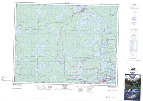
052E15 Keewatin Canada topo map, 1:50,000 scale
052E15 Keewatin NRCAN topographic map.
Includes UTM and GPS geographic coordinates (latitude and longitude). This 50k scale map is suitable for hiking, camping, and exploring, or you could frame it as a wall map.
Printed on-demand using high resolution, on heavy weight and acid free paper, or as an upgrade on a variety of synthetic materials.
Topos available on paper, Waterproof, Poly, or Tyvek. Usually shipping rolled, unless combined with other folded maps in one order.
- Product Number: NRCAN-052E15
- Parent Topo: TOPO-052E
- Map ID also known as: 052E15, 52E15
- Unfolded Size: Approximately 26" high by 36" wide
- Weight (paper map): ca. 55 grams
- Map Type: POD NRCAN Topographic Map
- Map Scale: 1:50,000
- Geographical region: Ontario, Canada
Neighboring Maps:
All neighboring Canadian topo maps are available for sale online at 1:50,000 scale.
Purchase the smaller scale map covering this area: Topo-052E
Spatial coverage:
Topo map sheet 052E15 Keewatin covers the following places:
- Allman's Bay - Cameron Bay - Darlington Bay - David Bay - Duck Bay - Flett Bay - Gavigan Bay - Holst Bay - Jackfish Bay - Kabastra Bay - Keewatin Bay - Little Tunnel Bay - Locke Bay - Lost Bay - Lost Bay - Mink Bay - Norman Bay - Portage Bay - Rat Portage Bay - Rice Bay - Rice Bay - Rideout Bay - Runions Bay - Safety Bay - Tunnel Bay - Coney Island Beach - Keewatin Beach - Bathgate's Point - Cache Point - Chadwick Point - Holst Point - Hospital Point - Logans Point - Mulock's Point - Pincushion Point - Silver Point - The Peninsula - Cobalts Narrows - Dufresne Rapids Narrows - Kimberley Rapids Narrows - Myrtle Rapids Narrows - Norman Channel - Palmerston's Channel - Second Rapids Narrows - Sweeney Channel - The Dalles - The Little Dalles - The Narrows - Kenora - Boys - Broderick - Gidley - Malachi - Pelican - Pellatt - Rudd - Umbach - Norman Dam - Réserve indienne The Dalles 38C - The Dalles 38C - The Dalles Indian Reserve 38C - Abbott's Island - Able Island - Bearfoot Island - Big Island - Birch Island - Boudreau Island - Boyd Island - Brown's Island - Cameron Island - Camp Island - Coney Island - Dog Island - Dufresne Island - Dynamite Island - East Brown's Island - Fiddler's Island - Foley Island - Fredericks Island - Graham Island - Hilliard's Island - Honeymoon Island - Indian Island - Jay Island - Johnsons Island - Keewatin Island - Kelly's Island - Kowbel's Island - Kris Island - Laurenson's Island - Little Jewel Island - Lowes Island - Morgans Island - Myrtle Island - Old Fort Island - Orde Islands - Padburge's Island - Porcupine Island - Potato Island - Punter's Island - Quarry Island - Runions Island - Schioler Island - Scott Island - Sellers Island - Sieler's Island - Squaw Island - Tataren Island - The Powderpuff - Tower Island - Treasure Island - Treaty Island - Tunnel Island - Virgin Island - Waller's Island - Wet Island - Adamson Lake - Alcock Lake - Alice Lake - Allin Lake - Annie Lake - Assin Lake - Bear Lake - Beaver Lake - Beer Lake - Belle Lake - Bludgeon Lake - Boyne Lake - Burdette Lake - Burwash Lake - Cameron Lake - Camp Four Lake - Castellar Lake - Cat Lake - Catastrophe Lake - Catherine Lake - Circle Lake - Cooch Lake - Cornell Lake - Corrigan Lake - Culloden Lake - Cygnet Lake - Dagimabrop Lake - Deception Lake - Duck Lake - Ena Lake - Esther Lake - Flapjack Lake - Fox Lake - Garia Lake - Gauntlet Lake - Gavigan Lake - George Lake - Greenwater Lake - Gun Lake - Ham Lake - Heart Lake - Helen Lake - Hunting Lake - Inn Lake - Island Lake - Jack Lake - James Lake - Joe Lake - Kalmar Lake - Kanatan Lake - King Lake - Knudsen Lake - Lac des Bois - Lake Catherine - Lake Charles - Lake Lulu - Lake of the Woods - Lily Lake - Little Boulder Lake - Little Kalmar Lake - Little Man Lake - Little Pickerel Lake - Little Sand Lake - Long Lake - Lost Lake - Louise Lake - Lulu Lake - Mack Lake - Malachi Lake - Man Lake - Marion Lake - Marshy Lake - Meekin Lake - Middle Lake - Monument Lake - Mosie Lake - Muriel Lake - Musca Lake - Muskrat Lake - Myrtle Lake - Nahany Lake - Nathalie Lake - Nelson Lake - North Otter Lake - Odjick Lake - Oldcamp Lake - Otter Lake - Paddy Lake - Pelicanpouch Lake - Pickerel Lake - Pistol Lake - Poplar Portage - Potato Lake - Precipice Lake - Puppy Lake - Raspberry Lake - Richard Lake - Ripple Lake - Rosina Lake - Roy Lake - Ruby Lake - Sand Lake - Sandy Lake - Seabury Lake - Selkirk Lake - Sheppard Lake - Sherwood Lake - Skiff Lake - Snail Lake - Sword Lake - Tremain Lake - Trout Lake - Twin Lake - Urquhart Lake - Wampum Lake - War Eagle Lake - Waseca Lake - Worth Lake - Camp Five Landing - Orange Hill - Black Sturgeon Rapids - Sniezek Rapids - Throat Rapids - Alice Creek - Black Sturgeon River - Castellar Creek - Catastrophe Creek - Circle Creek - Culloden Creek - Cygnet River - Deception Creek - Flapjack Creek - Fox Creek - Laclu Creek - Laclu River - MacFarlane River - Malachi Creek - Monument Creek - Mosie Creek - Paddy Creek - Pistol Creek - Pistol Creek - Rivière Winnipeg - Sheppard Creek - Sherwood Creek - Sword Creek - War Eagle Creek - Winnipeg River - Zodiac Creek - The Big Stretch - Menzies Reef - Muncer's Reef - Jaffray and Melick - Jaffray Melick - Busteed - Ena Lake - Keewatin - Laclu - Laclu - Lowther - Malachi - Minaki - Norman - Ostersund - Ottermere - Pellatt - Sherwood Lake - Tebo - Wade - Cranberry Swamp - Thompsons Slough


