
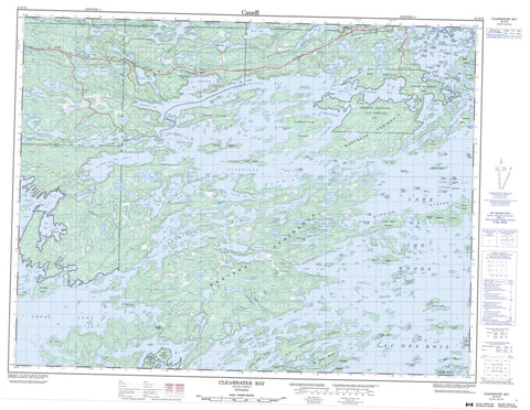
052E10 Clearwater Bay Canada topo map, 1:50,000 scale
052E10 Clearwater Bay NRCAN topographic map.
Includes UTM and GPS geographic coordinates (latitude and longitude). This 50k scale map is suitable for hiking, camping, and exploring, or you could frame it as a wall map.
Printed on-demand using high resolution, on heavy weight and acid free paper, or as an upgrade on a variety of synthetic materials.
Topos available on paper, Waterproof, Poly, or Tyvek. Usually shipping rolled, unless combined with other folded maps in one order.
- Product Number: NRCAN-052E10
- Parent Topo: TOPO-052E
- Map ID also known as: 052E10, 52E10
- Unfolded Size: Approximately 26" high by 36" wide
- Weight (paper map): ca. 55 grams
- Map Type: POD NRCAN Topographic Map
- Map Scale: 1:50,000
- Geographical region: Ontario, Canada
Neighboring Maps:
All neighboring Canadian topo maps are available for sale online at 1:50,000 scale.
Purchase the smaller scale map covering this area: Topo-052E
Spatial coverage:
Topo map sheet 052E10 Clearwater Bay covers the following places:
- Ash Bay - Bag Bay - Bulman Bay - Carl Bay - Clearwater Bay - Clytie Bay - Deception Bay - Echo Bay - Gauthier Bay - Hansens Bay - Helldiver Bay - Kendalls Inlet - Labyrinth Bay - Lily Pad Bay - Little Poplar Bay - Micrometer Bay - Oak Bay - Ogawa Bay - Ogema Bay - Outer Bay - Poplar Bay - Portage Bay - Ptarmigan Bay - Quandary Bay - Quiet Bay - Rat Portage Bay - Rheault Bay - Rush Bay - Trinity Bay - Turtle Bay - White Partridge Bay - Whiting Bay - Wiley Bay - Woodchuck Bay - Aylmer Point - Brûlé Point - Carmichael Point - Gateway Point - Infernal Point - Kellys Point - Kendall Point - Machin Point - McCallum Point - Northern Peninsula - Oak Point - Picnic Point - Point Aylmer - Sherlock Point - Spike Point - Spruce Point - Western Peninsula - Wiley Point - Yum Yum Point - Zigzag Point - Big Narrows - Canoe Channel - Corkscrew Channel - Crow Rock Channel - Deadbroke Channel - Keewatin Channel - Mud Portage Channel - Nebraska Avenue - Norman Channel - Quiet Channel - Second Channel - Shoal Lake Narrows - The Elbow - Tranquil Channel - Welcome Channel - Kenora - The Canyon - Boys - Broderick - Forgie - Gidley - Glass - Pellatt - Lake of the Woods 31B - Lake of the Woods Indian Reserve 31B - Rat Portage 38A - Rat Portage Indian Reserve 38A - Réserve indienne Lake of the Woods 31B - Réserve indienne Rat Portage 38A - Abbott Island - Barrier Islands - Big Fraser Island - Big Narrows Island - Big Tree Island - Birch Island - Bishop Point Island - Bulman Island - Cameron Island - Caragana Island - Cedar Island - Channel Island - Charlie Island - Cintiss Island - Coney Island - Copper Island - Corkscrew Island - Crescent Island - Cross Island - Crow Rock Island - Crowe Island - de Noyon Island - Deadbroke Island - Dingwall Island - Donald Duck Island - Doris Island - Drum Island - Duffy's Island - Dumbell Island - Espapeka Island - Ferris Island - Flat Rocker Island - Forrest Island - Fort Sam Island - Fortunes Island - Fox Island - Galt Island - Gourlay Island - Greenwood Island - Gull Island - Gun Club Island - Hare Island - Harris Island - Houghs Island - Iriam Island - Isle of Pines - Isle Ste. Marie - Kalamalka Island - Kennedy Island - Leisure Island - Lemon Island - Little Forrest Island - Little Rope Island - Luella Island - Mack Island - Mackies Island - Manitou Island - Martineau Island - Mather Island - McMillan Island - Menzia Island - Micrometer Island - Mouse Island - Net Nokwa Island - Oliver Island - Palisade Island - Pan Island - Panorama Island - Peewee Island - Pine Island - Pulfords Island - Queen Island - Rabson Island - Rileys Island - Rope Island - S Island - Saucer Island - Shammis Island - Shannons Island - Shragges Island - Slate Islands - St. George Island - St. Helena Island - Stanley Island - Sunbath Island - Teepee Island - Temperance Island - The Hump - The Tangle - The Tangle Islands - Thompson Island - Tippecanoe Island - Treaty Island - Turnbull Island - Twin Islands - Victoria Island - Whisky Island - Wolf Island - Yacht Club Island - Zigzag Island - Abernethy Lake - Bare Hill Lake - Barrage Lake - Birch Lake - Bluebell Lake - Boyne Lake - Brocket Lake - Bwan Lake - Canoe Lake - Caribou Lake - Cedarskirt Lake - Chebucto Lake - Chick Lake - Crowduck Lake - Cul de Sac Lake - Cuthbert Lake - Darkwater Lake - Deception Lake - Douglas Lake - Endportage Lake - Engineers Lake - Englis Lake - First Lake - Fox Lake - Gold Mountain Lake - Granite Lake - Hall Lake - Hatmaker Lake - Helen Lake - Hendrick Lake - Hertz Lake - Hinterland Lake - Hopkins Lake - Inglis Lake - Iris Lake - James Lake - Jennie Lake - Joyce Lake - Lac des Bois - Lake of the Woods - Lake of Two Mountains - Lily Lake - Lily Lake - Line Lake - Little Rock Lake - Lock Lake - Love Lake - Lownest Lake - McConnell Lake - McLauchlin Lake - Melborne Lake - Menzia Lake - Midportage Lake - Minkaduza Lake - Moss Lake - Moth Lake - Nola Lake - Owl Lake - Paddy Lake - Parth Lake - Partridge Lake - Patricia Lake - Potter Lake - Question Lake - Rice Lake - Ridge Lake - Ross Lake - Seager Lake - Shoal Lake - Slate Lake - Spitzi Lake - Spruce Lake - Squaw Lake - Umbel Lake - War Eagle Lake - Waseca Lake - Winnetka Lake - Ash Rapids - Upper Rapids - Bare Hill Creek - Crowduck Creek - Deception Creek - Granite Creek - Moss Creek - Paddy Creek - War Eagle Creek - Deadman Portage - Twelve Mile Portage - Gull Rock Reef - Line Reef - MacKenzie Reef - Menzies Reef - Wylies Reef - Jaffray and Melick - Jaffray Melick - Clearwater Bay - Granite Lake - Holmstrom Marsh - Holmstroms Marsh


