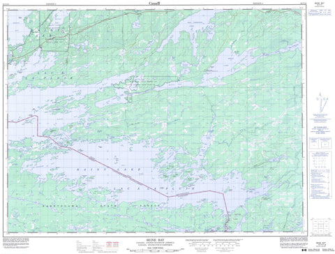
052C10 Seine Bay Canada topo map, 1:50,000 scale
052C10 Seine Bay NRCAN topographic map.
Includes UTM and GPS geographic coordinates (latitude and longitude). This 50k scale map is suitable for hiking, camping, and exploring, or you could frame it as a wall map.
Printed on-demand using high resolution, on heavy weight and acid free paper, or as an upgrade on a variety of synthetic materials.
Topos available on paper, Waterproof, Poly, or Tyvek. Usually shipping rolled, unless combined with other folded maps in one order.
- Product Number: NRCAN-052C10
- Parent Topo: TOPO-052C
- Map ID also known as: 052C10, 52C10
- Unfolded Size: Approximately 26" high by 36" wide
- Weight (paper map): ca. 55 grams
- Map Type: POD NRCAN Topographic Map
- Map Scale: 1:50,000
- Geographical region: Ontario, Canada
Neighboring Maps:
All neighboring Canadian topo maps are available for sale online at 1:50,000 scale.
Purchase the smaller scale map covering this area: Topo-052C
Spatial coverage:
Topo map sheet 052C10 Seine Bay covers the following places:
- Bleak Bay - Cormorant Bay - Finger Bay - Finlands Bay - Hale Bay - Island Bay - Little Grassy Bay - Moose Bay - Pothole Bay - Pound Net Bay - Rat River Bay - Redgut Bay - Seine Bay - Shelter Cove - Stokes Bay - Strange Bay - Swell Bay - Tunnel Bay - Willow Bay - Wind Bay - Birch Point - Deerhorn Point - Durant Point - Finger Point - Hallelujah Point - Kettle Point - Lighthouse Point - Mackenzie Point - Moose Point - Pow Ground Point - Vague Point - Wreck Point - American Channel - Brûlé Narrows - Canadian Channel - Canoe Channel - Friendly Passage - Hole in the Wall - International Channel - Kettle Channel - Kettle Channel - Little Brûlé Narrows - Sand Island Narrows - Farrington - Halkirk - Rainy River - Rainy Lake 26A - Rainy Lake Indian Reserve 26A - Réserve indienne Rainy Lake 26A - Réserve indienne Seine River 23B - Seine River 23B - Seine River Indian Reserve 23B - Anchor Island - Anchor Islands - Bald Island - Big Dry Island - Big Island - Blackpoint Island - Breezy Island - Brûlé Island - Channel Island - Chappie Island - Chicken Island - Dude Island - Green Island - Gunsight Island - Lindoo Island - Little Dry Island - Mackenzie Island - Moose Island - Oakpoint Island - Oscar Island - Pater Noster Island - Pater Noster Islands - Scott Island - Scott Islands - Three Sisters Islands - Bad Vermilion Lake - Barber Lake - Bliss Lake - Duff Lake - Dumbbell Lake - Finger Lake - Gagne Lake - Gallo Lake - Grassy Lake - Lac à la Pluie - Little Grassy Lake - Little Ottertail Lake - Lochart Lake - Melin Lake - Mudge Lake - Obashinsing Lake - Ottertail Lake - Pacitto Lake - Rainy Lake - Shoal Lake - Wild Potato Lake - Farrington Township Conservation Reserve - Shoal Lake Wilderness Area - Albertson Creek - Bad Vermilion Creek - Camp Creek - Chief Neverwash Creek - Duff Creek - East Branch Rat River - Falls River - McLeod Creek - Moose Camp Creek - Moose River - Ottertail River - Pipestone River - Rat River - Rat River - Seine River - Suckers Creek - Swamp Creek - West Branch Rat River - Devils Elbow - Canadian Portage - Melin Portage - Cedar Rock - Cedars Rock - Gull Rocks - Manitou Rock - Bear Pass - Leatherdale Landing - Old Mine Centre


