
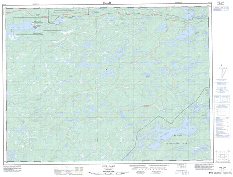
052C09 Pipe Lake Canada topo map, 1:50,000 scale
052C09 Pipe Lake NRCAN topographic map.
Includes UTM and GPS geographic coordinates (latitude and longitude). This 50k scale map is suitable for hiking, camping, and exploring, or you could frame it as a wall map.
Printed on-demand using high resolution, on heavy weight and acid free paper, or as an upgrade on a variety of synthetic materials.
Topos available on paper, Waterproof, Poly, or Tyvek. Usually shipping rolled, unless combined with other folded maps in one order.
- Product Number: NRCAN-052C09
- Parent Topo: TOPO-052C
- Map ID also known as: 052C09, 52C9, 52C09
- Unfolded Size: Approximately 26" high by 36" wide
- Weight (paper map): ca. 55 grams
- Map Type: POD NRCAN Topographic Map
- Map Scale: 1:50,000
- Geographical region: Ontario, Canada
Neighboring Maps:
All neighboring Canadian topo maps are available for sale online at 1:50,000 scale.
Purchase the smaller scale map covering this area: Topo-052C
Spatial coverage:
Topo map sheet 052C09 Pipe Lake covers the following places:
- West Bay - Banning Narrows - Sturgeon Falls - Rainy River - Réserve indienne Seine River 23A - Réserve indienne Sturgeon Falls 23 - Seine River 23A - Seine River Indian Reserve 23A - Sturgeon Falls 23 - Sturgeon Falls Indian Reserve 23 - Beaverhouse Lake - Bittern Lake - Burton Lake - Callaghan Lake - Calm Lake - Chase Lake - Cirrus Lake - Curtis Lake - Darby Lake - Day Lake - Dinner Lake - Duff Lake - Factor Lake - Five Mile Lake - Frederickson Lake - Gehl Lake - Greer Lake - Harnett Lake - Harvey Lake - Hutton Lake - Jackfish Hole - Kirk Lake - Lindgren Lake - Lyons Lake - Mahon Lake - McCaulay Lake - Mooney Lake - Moonshine Lake - Parker Lake - Partridge Crop Lake - Perley Lake - Pipe Lake - Potato Patch Lakes - Price Lake - Quetico Lake - Roadside Lake - Runciman Lake - Ryan Lake - Samuels Lake - Skip Lake - Sly Lake - Spratt Lake - Stewart Lake - Surprise Lake - Tie Hoist Lake - Warner Lake - Whalen Lake - Wild Potato Lake - Quetico Provincial Park - Bullmoose Creek - Camp Creek - Camp River - Chase Creek - Darby Creek - Duff Creek - Falls River - Mahon Creek - McOuat Creek - Mills Creek - Pipestone River - Price Creek - Quetico River - Seine River - Sly Creek - South Pipestone River - South Pipestone River - Suckers Creek - Surprise Creek - Swamp Creek - Whalen Creek - BigMcCaulay Portage - Calm Lake - Flanders - Horse Collar Junction - Laseine - Mathieu - Seine River Village


