
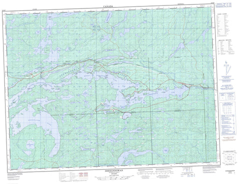
052B09 Shebandowan Canada topo map, 1:50,000 scale
052B09 Shebandowan NRCAN topographic map.
Includes UTM and GPS geographic coordinates (latitude and longitude). This 50k scale map is suitable for hiking, camping, and exploring, or you could frame it as a wall map.
Printed on-demand using high resolution, on heavy weight and acid free paper, or as an upgrade on a variety of synthetic materials.
Topos available on paper, Waterproof, Poly, or Tyvek. Usually shipping rolled, unless combined with other folded maps in one order.
- Product Number: NRCAN-052B09
- Parent Topo: TOPO-052B
- Map ID also known as: 052B09, 52B9, 52B09
- Unfolded Size: Approximately 26" high by 36" wide
- Weight (paper map): ca. 55 grams
- Map Type: POD NRCAN Topographic Map
- Map Scale: 1:50,000
- Geographical region: Ontario, Canada
Neighboring Maps:
All neighboring Canadian topo maps are available for sale online at 1:50,000 scale.
Purchase the smaller scale map covering this area: Topo-052B
Spatial coverage:
Topo map sheet 052B09 Shebandowan covers the following places:
- Ambush Bay - Beaver Bay - Blizzard Bay - Camp One Bay - Discovery Bay - East Bay - Green Bay - Kabaigon Bay - Martin Bay - Moose Bay - Postans Bay - Rossmere Bay - Shelter Bay - Skunk Bay - South Bay - Southwest Bay - Stewart Bay - Swamp Bay - Three Mile Bay - Trout Bay - Young Bay - Castor Beach - Black Point - Carson Point - Crescent Point - Discovery Point - Munro Point - Rudolph's Point - Shebamboo Point - Wolseley Point - Ambush Narrows - Deafey's Narrows - First Narrows - Middle Gap - Second Narrows - Steamer Channel - The Narrows - Bégin - Blackwell - Conacher - Duckworth - Hagey - Haines - Lamport - Laurie - Anderson Island - Big Bare Island - Birch Island - Boyes Island - Burnt Island - Burnt Island - Cache Island - Castor Island - Copper Island - Cranberry Island - Cullen Island - Cyclone Island - Kabaigon Island - Little Bare Island - Pernu Island - Pigs Island - Pine Island - Rotary Island - Shelter Island - Teapot Island - Twenty Minute Island - Whiskey Island - Windigo Island - Wolf Island - Alpha Lake - Amp Lake - Andy Lake - Anne Lake - Bass Lake - Beaver Lake - Bowes Lake - Camp Lake - Cascade Lake - Cinder Lake - Clovenhoof Lake - Conklin Lake - Cowles Lake - Dakota Lake - Davison Lake - Drift Lake - East Divide Lake - Far Lake - Fraser Lake - Gilt Lake - Graham Lake - Greenwater Lake - Harju's Lake - Harnden Lake - Highcliff Lake - Holstrom Lake - Home Lake - Horseshoe Lake - Jackfish Lake - Kabaigon Lake - Kashabowie Lake - Kekekuab Lake - Lily Lake - Little Athelstane Lake - Little Greenwater Lake - Little Kabaigon Lake - Little Kashabowie Lake - Loch Erne - Loch Macdougall - Loch McLean - Loch Muich - Loch Smith - Long Lake - Lower Sabrina Lake - Lower Shebandowan Lake - Maria Lake - Mathe Lake - Middle Shebandowan Lake - Minnow Lake - Mud Lake - Murphy Lake - Nancy's Lake - Otto Lake - Peewatai Lake - Pinecone Lake - Pistol Lake - Postans Lake - Roundrock Lake - Sabrina Lake - Shafton Lake - Shebandowan Lakes - Skram Lake - Star Lake - Swamp Lake - Tinto Lake - Turner Lake - Two Mile Lake - Upper Sabrina Lake - Upper Shebandowan Lake - White Pine Lake - Zero Lake - Beaver Hill - Kashabowie Provincial Park - Little Greenwater Lake Provincial Nature Reserve - Athelstane Creek - Crayfish Creek - Drift Creek - Gold Creek - Greenwater Creek - Harnden Creek - Hoof Creek - Kashabowie River - Kekek Brook - Kekek Creek - Pinecone Creek - Sabrina Creek - Shebandowan River - Swamp River - Annex - Kabaigon - Kashabowie - Postans - Rossmere - Shebandowan


