
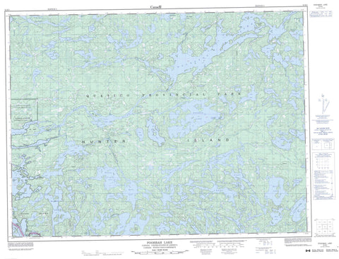
052B05 Poohbah Lake Canada topo map, 1:50,000 scale
052B05 Poohbah Lake NRCAN topographic map.
Includes UTM and GPS geographic coordinates (latitude and longitude). This 50k scale map is suitable for hiking, camping, and exploring, or you could frame it as a wall map.
Printed on-demand using high resolution, on heavy weight and acid free paper, or as an upgrade on a variety of synthetic materials.
Topos available on paper, Waterproof, Poly, or Tyvek. Usually shipping rolled, unless combined with other folded maps in one order.
- Product Number: NRCAN-052B05
- Parent Topo: TOPO-052B
- Map ID also known as: 052B05, 52B5, 52B05
- Unfolded Size: Approximately 26" high by 36" wide
- Weight (paper map): ca. 55 grams
- Map Type: POD NRCAN Topographic Map
- Map Scale: 1:50,000
- Geographical region: Ontario, Canada
Neighboring Maps:
All neighboring Canadian topo maps are available for sale online at 1:50,000 scale.
Purchase the smaller scale map covering this area: Topo-052B
Spatial coverage:
Topo map sheet 052B05 Poohbah Lake covers the following places:
- Heron Bay - Martin Bay - Rice Bay - Wegwagum Bay - Sturgeon Narrows - Twin Falls - Neguaguon Lake Indian Reserve 25D - Réserve indienne Neguaguon Lake 25D - Bell Island - Birch Island - Drift Island - Elk Lake - Hilly Island - Hunter Island - Irving Island - Lou Island - May Island - Moosehide Island - Scripture Island - Allan Lake - Andrews Lake - Argo Lake - Badwater Lake - Ballard Lake - Bass Lake - Bee Lake - Bentpine Lake - Berniece Lake - Bottle Lake - Boulder Lake - Brent Lake - Brewer Lake - Burntside Lake - Burt Lake - Camel Lake - Clair Lake - Cone Lake - Conmee Lake - Creasy Lake - Dahlin Lake - Darkwater Lake - Darky Lake - Delahey Lake - Eyelet Lake - Fair Lake - Fred Lake - Gamblemater Lake - Gratton Lake - Hoare Lake - Hoffman Lake - Hurn Lake - Iron Lake - Jack Lake - Jew Lake - Joyce Lake - Lac la Croix - Little Pine Lake - Little Roland Lake - March Lake - Marj Lake - McAree Lake - McIntyre Lake - Middle Roland Lake - Milt Lake - Minn Lake - Moxness Lake - Nan Lake - Omeme Lake - Orion Lake - Paulene Lake - Pelee Lake - Point Lake - Pond Lake - Poohbah Lake - Pooh-bah Lake - Pulling Lake - Red Pine Lake - Roland Lake - Rouge Lake - Roulston Lake - Russell Lake - Scarlet Lake - Shaw Lake - Snow Lake - Sturgeon Lake - Suzanette Lake - Tanner Lake - Ted Lake - That Lake - Trail Lake - Tubman Lake - Veron Lake - Viger Lake - Walsh Lake - Wicksteed Lake - Wildgoose Lake - William Lake - Wink Lake - Your Lake - Warrior Hill - Quetico Provincial Park - Bottle Rapids - Brewer Rapids - Flat Rapids - McAree Rapids - Tanners Rapids - Allan Creek - Andrews Creek - Bentpine Creek - Bottle River - Cutty Creek - Darkwater River - Jean Creek - Maligne River - Namakan River - Poohbah Creek - Siobhan River - Trail Creek - Tubman Creek - Wicksteed Creek - Wildgoose Creek - Black Robe Portage - Bottle Portage - Island Portage - Maligne Portage - Lac la Croix


