
052A05 Kakabeka Falls Canada topo map, 1:50,000 scale
052A05 Kakabeka Falls NRCAN topographic map.
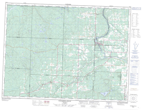
Includes UTM and GPS geographic coordinates (latitude and longitude). This 50k scale map is suitable for hiking, camping, and exploring, or you could frame it as a wall map.
Printed on-demand using high resolution, on heavy weight and acid free paper, or as an upgrade on a variety of synthetic materials.
Topos available on paper, Waterproof, Poly, or Tyvek. Usually shipping rolled, unless combined with other folded maps in one order.
- Product Number: NRCAN-052A05
- Parent Topo: TOPO-052A
- Map ID also known as: 052A05, 52A5, 52A05
- Unfolded Size: Approximately 26" high by 36" wide
- Weight (paper map): ca. 55 grams
- Map Type: POD NRCAN Topographic Map
- Map Scale: 1:50,000
- Geographical region: Ontario, Canada
Neighboring Maps:
All neighboring Canadian topo maps are available for sale online at 1:50,000 scale.
Purchase the smaller scale map covering this area: Topo-052A
Spatial coverage:
Topo map sheet 052A05 Kakabeka Falls covers the following places:
- Kakabeka Falls - Adrian - Aldina - Conmee - Gillies - Horne - Laurie - Lybster - Marks - Neebing - O'Connor - Oliver - Paipoonge - Sackville - Scoble - Strange - Adair Lake - Adrian Lake - Binabick Lake - Cedarlimb Lake - Echo Lake - Elgin Lake - Float Lake - Gold Lake - Length Lake - Marble Lake - Marks Lake - Oliver Lake - Peridotite Lake - Pete Lake - Pictured Lake - Rockstone Lake - Stephens Lake - Strange Lake - Thunder Lake - Turn Lake - Twin Birch Lake - Twist Lake - Champ de manoeuvre Kakabeka Falls - Kakabeka Falls Training Area - Badger Mountain - Beaver Mountain - Candy Mountain - Drews Mountain - Knob Hill - Little Pig - Rabbit Mountain - Silver Hill - Silver Mountain - Stanley Hill - The Palisades - Conmee - Gillies - O'Connor - Oliver - Oliver Paipoonge - Paipoonge - Cedar Creek Conservation Reserve - Divide Ridge Provincial Nature Reserve - Kakabeka Falls Provincial Park - Beaver Creek - Beaver Dam Creek - Brûlé Creek - Carson Creek - Cedar Creek - Corbett Creek - Kaministikwia River - Kaministiquia River - Matawin River - North River - O'Connor Creek - Oliver Creek - Otter Creek - Pitch Creek - Sackville Creek - Serpent Creek - Silver Creek - Silver Falls Creek - Sitch Creek - South Cedar Creek - Whitefish River - Whitewood Creek - Wiegand River - Neebing - Flint - Harstone - Hume - Hymers - Kakabeka Falls - Lee - Millar - Mokomon - Murillo - Nolalu - O'Connor - Sellars - Silver Mountain - Stanley - Veletta


