
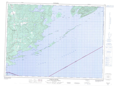
052A03 Jarvis River Canada topo map, 1:50,000 scale
052A03 Jarvis River NRCAN topographic map.
Includes UTM and GPS geographic coordinates (latitude and longitude). This 50k scale map is suitable for hiking, camping, and exploring, or you could frame it as a wall map.
Printed on-demand using high resolution, on heavy weight and acid free paper, or as an upgrade on a variety of synthetic materials.
Topos available on paper, Waterproof, Poly, or Tyvek. Usually shipping rolled, unless combined with other folded maps in one order.
- Product Number: NRCAN-052A03
- Parent Topo: TOPO-052A
- Map ID also known as: 052A03, 52A3, 52A03
- Unfolded Size: Approximately 26" high by 36" wide
- Weight (paper map): ca. 55 grams
- Map Type: POD NRCAN Topographic Map
- Map Scale: 1:50,000
- Geographical region: Ontario, Canada
Neighboring Maps:
All neighboring Canadian topo maps are available for sale online at 1:50,000 scale.
Purchase the smaller scale map covering this area: Topo-052A
Spatial coverage:
Topo map sheet 052A03 Jarvis River covers the following places:
- Big Trout Bay - Cloud Bay - Cosgrave Bay - Crystal Bay - Dawson Bay - Flatland Harbour - Jarvis Bay - Little Trout Bay - Mink Bay - Pigeon Bay - Pine Bay - Prince Bay - Sturgeon Bay - Thunder Bay - Victoria Cove - Caldwell Point - Greenstone Point - Jarvis Point - Keefer Point - McKellar Point - Mink Point - Pine Point - Prince Point - Russell Point - Sturgeon Point - Turtle Head - Wiley Point - Zealand Spit - Spar Channel - Blake - Crooks - Neebing - Albert Islands - Anderson Island - Angus Islands - Beaver Island - Birch Island - Bonnet Island - Bradshaw Island - Caldwell Island - Campbell Island - Cloud Islands - Cone Island - Deadman Island - Devil Island - Dog Island - Eva Islands - Flatland Island - Hamilton Islands - Harty Island - Hawken Island - Jarvis Island - Magee Island - Mink Island - Moonshine Island - Muskrat Island - Naomi Island - Nisbet Island - Pie Island - Prefontaine Island - Robertson Island - Robertson Islands - Singleton Island - Sister Islands - Slipper Island - South McKellar Island - Spar Island - Steamboat Island - Sturgeon Island - Sucker Island - Thompson Island - Tiger Island - Victoria Island - White Island - Windigo Island - Caldwell Lake - Lac Supérieur - Lake Superior - Loch Lomond - Moon Lake - Perch Lake - Ward Lake - Le Pâté - Mount Mollie - The Sugarloaf - Le Pate Provincial Nature Reserve - Thompson Island Provincial Nature Reserve - Cloud River - Jarvis River - Lomond River - Alexander Reef - Arabian Rock - Baker Rock - Caldwell Shoal - Cohen Rock - Craig Rock - Flatland Reef - Iroquois Rock - Jarvis Rock - Lord Stanley Rock - Pinnacle Rock - Rolland Rock - Rowan Reef - Sly Rock - Spar Reef - Swan Rock - Tiger Rock - Neebing - Cloud Bay - Jarvis River


