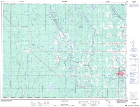
042H03 Cochrane Canada topo map, 1:50,000 scale
042H03 Cochrane NRCAN topographic map.
Includes UTM and GPS geographic coordinates (latitude and longitude). This 50k scale map is suitable for hiking, camping, and exploring, or you could frame it as a wall map.
Printed on-demand using high resolution, on heavy weight and acid free paper, or as an upgrade on a variety of synthetic materials.
Topos available on paper, Waterproof, Poly, or Tyvek. Usually shipping rolled, unless combined with other folded maps in one order.
- Product Number: NRCAN-042H03
- Parent Topo: TOPO-042H
- Map ID also known as: 042H03, 42H3, 42H03
- Unfolded Size: Approximately 26" high by 36" wide
- Weight (paper map): ca. 55 grams
- Map Type: POD NRCAN Topographic Map
- Map Scale: 1:50,000
- Geographical region: Ontario, Canada
Neighboring Maps:
All neighboring Canadian topo maps are available for sale online at 1:50,000 scale.
Purchase the smaller scale map covering this area: Topo-042H
Spatial coverage:
Topo map sheet 042H03 Cochrane covers the following places:
- Blount - Bradburn - Calder - Clute - Colquhoun - Dargavel - Fournier - Glackmeyer - Kendrey - Lamarche - Leitch - Lennox - Ottaway - Abams Lake - Adams Lake - Amik Lake - Ante Lake - Bamford Lake - Bear Lake - Beaver House Lake - Belisle Lake - Blackburn Lake - Blue Lake - Bondy Lake - Bower Lake - Bradette Lake - Brown Lake - Chartrand Lake - Chenier Lake - Clute Lake - Commando Lake - Connon Lake - Crates Lake - Crickard Lake - Dales Lake - Deception Lake - Duff Lake - Dunkel Lake - Dunn Lake - East Bradburn Lake - Forsythe Lake - Fournier Lake - Fowler Lake - Genier Lake - Green Lake - Greensward Lake - Hector Lake - Horseshoe Lake - Hydro Lake - Jinks Lake - Jowett Lake - Keefer Lake - Kennedy Lake - Kidney Lake - Lac Chartrand - Lac Commando - Lac Ménard - Lac Rancourt - Lee Lake - Leroy Lake - Levesseur Lake - Lillabelle Lake - Little Connon Lake - Little Menard Lake - Lloyd Lake - Lockett Lake - Lower Deception Lake - McDowell Lake - Menard Lake - Minnow Lake - Morin Lake - Mud Lake - Nault Lake - Norman Lake - O'Malley Lake - Palangio Lake - Paradise Lake - Park Lake - Parks Lake - Peterson Lake - Poker Lake - Prior Lake - Rawcourt Lake - Sandbar Lake - Shier Lake - Silver Queen Lake - Slaughterhouse Lake - Sommerville Lake - Spring Lake - Steele Lake - Syndicate Lake - Tish Lake - Upton Lake - Welsh Lake - Wiskin Lake - Wolfe Lake - Woodland Lake - Zuck Lake - Glackmeyer - Greenwater Provincial Park - Carter Rapids - Long Sault Rapids - Neelands Rapids - Sankey Rapids - Abitibi River - Blackburn Creek - Bower Creek - Buskegau River - Calder Creek - Chenier Creek - Clute Creek - Deception Creek - Dina Creek - East Bradburn Creek - Eastford Creek - Foster Creek - Fournier Creek - Fowler Creek - Frederick House River - Genier Creek - Lennox Creek - Mondor Creek - Nesbitt Creek - North Driftwood River - Pellman Creek - Rivière Abitibi - Sauve Creek - Sheriff Creek - Smith Creek - South Bower Creek - Wicklow River - Cochrane - Smooth Rock Falls - Buskegau - Clute - Cochrane - Driftwood - Frederick - Frederickhouse - Genier - Hunta - Larocque


