
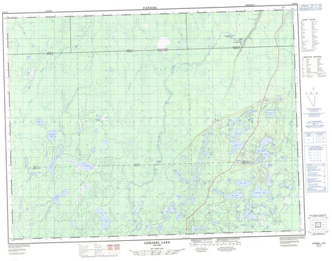
042F10 Ahmabel Lake Canada topo map, 1:50,000 scale
042F10 Ahmabel Lake NRCAN topographic map.
Includes UTM and GPS geographic coordinates (latitude and longitude). This 50k scale map is suitable for hiking, camping, and exploring, or you could frame it as a wall map.
Printed on-demand using high resolution, on heavy weight and acid free paper, or as an upgrade on a variety of synthetic materials.
Topos available on paper, Waterproof, Poly, or Tyvek. Usually shipping rolled, unless combined with other folded maps in one order.
- Product Number: NRCAN-042F10
- Parent Topo: TOPO-042F
- Map ID also known as: 042F10, 42F10
- Unfolded Size: Approximately 26" high by 36" wide
- Weight (paper map): ca. 55 grams
- Map Type: POD NRCAN Topographic Map
- Map Scale: 1:50,000
- Geographical region: Ontario, Canada
Neighboring Maps:
All neighboring Canadian topo maps are available for sale online at 1:50,000 scale.
Purchase the smaller scale map covering this area: Topo-042F
Spatial coverage:
Topo map sheet 042F10 Ahmabel Lake covers the following places:
- Arnott - Cochrane - Cross - Frost - Hiawatha - Kohler - McCoig - McEwing - McMillan - Mercer - Ahmabel Lake - Anderson Lake - Angela Lake - Angus Lake - Anita Lake - Arnott Lake - Audrey Lake - Big Skunk Lake - Boice Lake - Buck Lake - Budd Lake - Bun Lake - Cantin Lake - Claire Lake - Clavelle Lake - Corine Lake - Crow Lake - Daniel Lake - David Lake - Dodds Lake - Douglas Lake - Eagle Lake - East Ahmabel Lake - Elmer Lake - Emond Lake - Eric Lake - Evelyn Lake - Fisher Lake - Flett Lake - Fournier Lake - Fraser Lake - Freddie Lake - Friday Lake - Frost Lake - Gagnon Lake - Goldie Lake - Hook Lake - Humberstone Lake - Insect Lake - Jaw Lake - Jig Lake - Johnston Lake - Konk Lake - Lapworth Lake - Leaf Lake - Lewis Lake - Little Skunk Lake - Lizo Lake - Lloyd Lake - Lorraine Lake - Martin Lake - Mask Lake - McEwing Lake - Melody Lake - Mercer Lake - Millie Lake - Mink Lake - Mole Lake - Murphy Lake - Myrtle Lake - Paddle Lake - Paddy Lake - Perrin Lake - Pointing Lake - Redpine Lake - Roger Lake - Saw Lake - Scuckasu Lake - Shalla Lake - Shapeless Lake - Shrew Lake - Sider Lake - Skipper Lake - Slim Lake - Souter Lake - Starling Lake - Susie Lake - Taylor Lake - Toad Lake - Trodd Lake - Turnip Lake - Young Lake - Dirty Bush Rapids - Gull Rock Rapids - Jackpine Rapids - Rough Rock Rapids - Trout Rapids - White Owl Rapids - Bad River - Bun Creek - Fraser River - Frost Creek - Little Fraser River - Little Pitopiko River - Little Skunk River - McEwing Creek - Mercer Creek - Millie Creek - Nagagami River - Pitopiko River - Scuckasu Creek - Skunk River - Dirty Bush Portage - Gull Rock Portage - Jackpine Portage - Rough Rock Portage - Trout Portage - The Canyon


