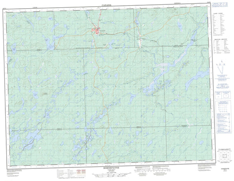
042F02 Hornepayne Canada topo map, 1:50,000 scale
042F02 Hornepayne NRCAN topographic map.
Includes UTM and GPS geographic coordinates (latitude and longitude). This 50k scale map is suitable for hiking, camping, and exploring, or you could frame it as a wall map.
Printed on-demand using high resolution, on heavy weight and acid free paper, or as an upgrade on a variety of synthetic materials.
Topos available on paper, Waterproof, Poly, or Tyvek. Usually shipping rolled, unless combined with other folded maps in one order.
- Product Number: NRCAN-042F02
- Parent Topo: TOPO-042F
- Map ID also known as: 042F02, 42F2, 42F02
- Unfolded Size: Approximately 26" high by 36" wide
- Weight (paper map): ca. 55 grams
- Map Type: POD NRCAN Topographic Map
- Map Scale: 1:50,000
- Geographical region: Ontario, Canada
Neighboring Maps:
All neighboring Canadian topo maps are available for sale online at 1:50,000 scale.
Purchase the smaller scale map covering this area: Topo-042F
Spatial coverage:
Topo map sheet 042F02 Hornepayne covers the following places:
- Shadrock Bay - Cedar Point - Bayfield - Beaton - Chelsea - Haig - Larkin - Lascelles - Lessard - Lipton - Wicksteed - Canary Island - Crossover Island - Hillman Island - Schmidt's Island - Agreen Lake - Angle Lake - Armitage Lake - Banana Lake - Bay Lake - Bayfield Lake - Beavertrap Lake - Belanger Lake - Black Beaver Lake - Black Fox Lake - Blue Lake - Bobcat Lake - Bone Lake - Buffalo Island Lake - Buffington Lake - Burnt Lake - Cat Lake - Charlie May's Lake - Chelsea Lake - Corner Lake - Cree Lake - Deadwood Lake - Dismal Lake - Doran Lake - East Government Lake - Fall-In Lake - First Government Lake - Government Lake - Gretchel Lake - Haken Lake - Hornepayne Lakes - Ice Lake - Jay Lake - Johnson Lake - Laird's Lake - Lake Placid - Larkin Lake - Lascelles Lake - Little Chelsea Lake - Lovely Lake - Lower Bobcat Lake - Marten Lake - McCoy Lake - Mitchell Lake - Moonlight Lake - Muskrat's House Lake - Newton Lake - Norn Lake - Otter Lake - Rat Lake - Sand Lake - Sandy's Lake - Savoie Lake - Sawmill Lake - Second Charlie May's Lake - Second Government Lake - Shadrock Lake - Shaw Lake - Smokey Lake - South Bayfield Lake - Spectacle Lake - Spurline Lake - St. Onge's Lake - That Man's Lake - The Other Man's Lake - This Man's Lake - Wabos Lake - West Larkin Lake - White Owl Lake - Whitepine Lake - Wilson Lake - Chelsea Mountain - Hornepayne - Wicksteed - Island Rapids - Beaton River - Bobcat Creek - Chelsea Creek - Cree Creek - Deadwater Creek - Gretchel Creek - Hans Creek - Harstone Creek - Hornepayne Creek - Jackfish River - Larkin Creek - Lascelles Creek - Lennon Creek - Little Chelsea Creek - Little Jackfish River - Newton Creek - Otter Creek - Penhurst Creek - Shadrock Creek - Shekak River - West Beaton River - White Owl Creek - Jackpine Portage - Becker - Cree - Hornepayne - Morrison River Landing - Shekak


