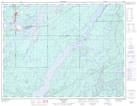
042E10 Geraldton Canada topo map, 1:50,000 scale
042E10 Geraldton NRCAN topographic map.
Includes UTM and GPS geographic coordinates (latitude and longitude). This 50k scale map is suitable for hiking, camping, and exploring, or you could frame it as a wall map.
Printed on-demand using high resolution, on heavy weight and acid free paper, or as an upgrade on a variety of synthetic materials.
Topos available on paper, Waterproof, Poly, or Tyvek. Usually shipping rolled, unless combined with other folded maps in one order.
- Product Number: NRCAN-042E10
- Parent Topo: TOPO-042E
- Map ID also known as: 042E10, 42E10
- Unfolded Size: Approximately 26" high by 36" wide
- Weight (paper map): ca. 55 grams
- Map Type: POD NRCAN Topographic Map
- Map Scale: 1:50,000
- Geographical region: Ontario, Canada
Neighboring Maps:
All neighboring Canadian topo maps are available for sale online at 1:50,000 scale.
Purchase the smaller scale map covering this area: Topo-042E
Spatial coverage:
Topo map sheet 042E10 Geraldton covers the following places:
- Barton Bay - Birch Bay - Boot Bay - Devilfish Bay - Hardrock Bay - Jackfish Bay - Magnet Bay - Portage Bay - Siwash Bay - Southwest Arm - Westside Bay - Buckety Point - Burnt Hill Point - Discovery Point - Kickick Point - Red Rock Point - Sevenmile Point - Main Narrows - Northern Narrows - West Narrows - Abrey - Ashmore - Coltham - Croll - Errington - McKelvie - Salsberg - Ginoogaming First Nation - Ginoogaming First Nation Indian Reserve 77 - Long Lake Indian Reserve 77 - Réserve indienne Ginoogaming First Nation 77 - Réserve indienne Long Lake 77 - Baldhead Island - Bell Island - First Island - Fox Island - Second Island - Third Island - Ashmore Lake - Barn Lake - Beaverhouse Lake - Bikerace Lake - Cache Lake - Calong Lake - Cecile Lake - Corri Lake - Crabtree Lake - Cray Lake - Croll Lake - Duckling Lake - Dumbbell Lake - Eldee Lake - Emilie Lake - Forrester Lake - Galloway Lake - Gog Lake - Greenwater Lake - Grehan Lake - Horsehead Lake - Kenogamisis Lake - Lambchop Lake - Little Gallander Lake - Little Needle Lake - Little Nye Lake - Lobo Lake - Long Lake - Lucier Lake - Maben Lake - Making Ground Lake - McBean Lake - McKay Lake - McKelvie Lake - McLeod Lake - Milbean Lake - Milfair Lake - Milne Lake - Mineral Lake - Mint Lake - Mosher Lake - Mosquito Lake - Needle Lake - Nye Lake - Oly Lake - Parakeet Lake - Pataban Lake - Peden Lake - Puppy Lake - Pussy Lake - Quintuplet Lake - Ragged Lake - Rockyshore Lake - Rod Lake - Siwash Lake - Skinner Lake - Sperm Lake - Star Lake - Suicide Lake - Sweezey Lake - The Lagoon - Threepoint Lake - Tricorn Lake - Triplet Lakes - Twomey Lake - Wallace Lake - Wishbone Lake - Y Lake - Yak Lake - Yvonne Lake - Champ de manoeuvre Geraldton - Geraldton Training Area - Beardmore - Nakina - MacLeod Provincial Park - Steel River Provincial Park - Flat Rapids - Lower Flat Rapids - Goldfield Creek - Hardrock Creek - Kenogamisis River - Kinonge Creek - Lambchop Creek - Little Steel River - Magnet Creek - Making Ground River - McBean Creek - Milfair Creek - Mineral Creek - Needle Creek - Rogers Creek - Skinner Creek - Sperm Creek - Suckle Creek - Triplet Creek - Summit Portage - Greenstone - Geraldton - Hardrock - Hardrock - Hardrock Mines - Hardrock Townsite - Jonesville - Langmuir - Little Longlac - MacLeod - Rosedale Point - Theresa


