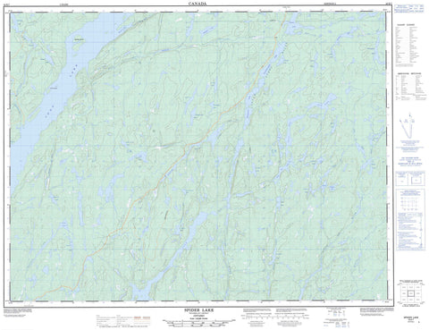
042E07 Spider Lake Canada topo map, 1:50,000 scale
042E07 Spider Lake NRCAN topographic map.
Includes UTM and GPS geographic coordinates (latitude and longitude). This 50k scale map is suitable for hiking, camping, and exploring, or you could frame it as a wall map.
Printed on-demand using high resolution, on heavy weight and acid free paper, or as an upgrade on a variety of synthetic materials.
Topos available on paper, Waterproof, Poly, or Tyvek. Usually shipping rolled, unless combined with other folded maps in one order.
- Product Number: NRCAN-042E07
- Parent Topo: TOPO-042E
- Map ID also known as: 042E07, 42E7, 42E07
- Unfolded Size: Approximately 26" high by 36" wide
- Weight (paper map): ca. 55 grams
- Map Type: POD NRCAN Topographic Map
- Map Scale: 1:50,000
- Geographical region: Ontario, Canada
Neighboring Maps:
All neighboring Canadian topo maps are available for sale online at 1:50,000 scale.
Purchase the smaller scale map covering this area: Topo-042E
Spatial coverage:
Topo map sheet 042E07 Spider Lake covers the following places:
- Blackwater Bay - Redpine Bay - Clode Island - Halfway Island - Horse Islands - Akebia Lake - Androsace Lake - Anthemis Lake - Aster Lake - Berberis Lake - Bluffy Lake - Burrow Lake - Buxus Lake - Catawba Lake - Celastrus Lake - Concord Lake - Eaglecrest Lake - Evonymus Lake - Gallander Lake - Galloway Lake - Grehan Lake - Grin Lake - Hatley Lake - Hedera Lake - Jarvis Lake - Kawabatongog Lake - Larix Lake - Laughter Lake - Little Gallander Lake - Little Jarvis Lake - Little Pic Lake - Little Tungsten Lake - Long Lake - Lucier Lake - Lychnis Lake - Nepeta Lake - Pachysandra Lake - Palmquist Lake - Periwinkle Lake - Ragged Lake - Renaud Lake - Savoie Lake - Sedum Lake - Sherry Lake - Smile Lake - Spider Lake - Spinner Lake - Spurge Lake - Steel Lake - Stewart Lake - Sun Lake - Trish Lake - TungstenLake - Vinca Lake - Viridis Lake - Yucca Lake - Zircon Lake - Long Lake Conservation Reserve - Steel River Provincial Park - Akebia Creek - Aster Creek - Blackwater Creek - Bluffy Creek - Catlonite Creek - Gallander Creek - Galloway Creek - Galloway Creek - Kagiano River - Kamuck River - Little Pic River - Little Steel River - Lucier Creek - Lucier Creek - Needle Creek - Pout River - Renaud Creek - Sherry Creek - Spider Creek - Steel River - Stevens Creek - Tungsten Creek


