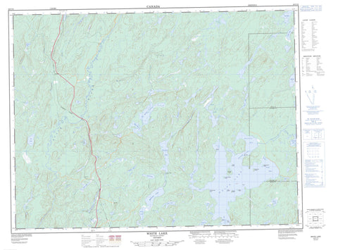
042C13 White Lake Canada topo map, 1:50,000 scale
042C13 White Lake NRCAN topographic map.
Includes UTM and GPS geographic coordinates (latitude and longitude). This 50k scale map is suitable for hiking, camping, and exploring, or you could frame it as a wall map.
Printed on-demand using high resolution, on heavy weight and acid free paper, or as an upgrade on a variety of synthetic materials.
Topos available on paper, Waterproof, Poly, or Tyvek. Usually shipping rolled, unless combined with other folded maps in one order.
- Product Number: NRCAN-042C13
- Parent Topo: TOPO-042C
- Map ID also known as: 042C13, 42C13
- Unfolded Size: Approximately 26" high by 36" wide
- Weight (paper map): ca. 55 grams
- Map Type: POD NRCAN Topographic Map
- Map Scale: 1:50,000
- Geographical region: Ontario, Canada
Neighboring Maps:
All neighboring Canadian topo maps are available for sale online at 1:50,000 scale.
Purchase the smaller scale map covering this area: Topo-042C
Spatial coverage:
Topo map sheet 042C13 White Lake covers the following places:
- Chiefs Bay - Clay Bay - Ginozhe Bay - Lampi's Bay - North Bay - Shabotik Bay - Spruce Bay - Minisidawanga Beach - Burnt Point - Graveyard Point - Sawmill Point - Ajitamo Narrows - Obawanga Narrows - The Narrows - Atikameg - Bryant - Glen - McGill - Thunder Bay - Cree Island - Little Windigo Island - Manido Island - Mashkigomin Island - Pow Island - Steamboat Island - Tent Island - Tern Islands - Windigo Island - Amwri Lake - Atikameg Lake - Barbara Lake - Buie Lake - Bullring Lake - Caribou Throat Lake - Clay Lake - Dead Otter Lake - Dorothy Lake - Dotted Lake - Ellis Lake - Eric Lake - Etna Lake - Felto Lake - Galoche Lake - Garnham Lake - Huggard Lake - Ishkodewabo Lake - Ketchup Lake - Lampi's Lake - Lampson Lake - Line Lake - Little Dead Otter Lake - Little Wabikoba Lake - Lunny Lake - Marie Lake - McGill Lake - Mickey Lake - Musher Lake - Olga Lake - Pan Lake - Petrant Lake - Philip Lake - Pickle Lake - Pinegrove Lake - Ravine Lake - Snowball Lake - Solong Lake - Spider Lake - Summers Lake - Theresa Lake - Tri Lake - Twist Lake - Valley Lake - Wabikoba Lake - White Lake - Isko Dewabo Lake Complex Conservation Reserve - Kwinkwaga Ground Moraine Uplands Conservation Reserve - Pan Lake Fen Provincial Nature Reserve - Pan Lake Fen Provincial Park - White Lake Peatlands Provincial Nature Reserve - Amwri Creek - Barbara Creek - Barehead Creek - Bertrand Creek - Black River - Bullring Creek - Cedar Creek - Clay Creek - Etna Creek - Gowan Creek - Jenny Creek - Kwinkwaga River - McGill Creek - Mickey Creek - Mobert Creek - Namebin Creek - Philips Creek - Pickle Creek - Shabotik River - Valley Creek - Wabikoba Creek - Ziziginiga Creek - Crab Rocks - Agonzon - Amwri


