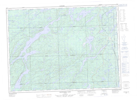
042C01 Manitowik Lake Canada topo map, 1:50,000 scale
042C01 Manitowik Lake NRCAN topographic map.
Includes UTM and GPS geographic coordinates (latitude and longitude). This 50k scale map is suitable for hiking, camping, and exploring, or you could frame it as a wall map.
Printed on-demand using high resolution, on heavy weight and acid free paper, or as an upgrade on a variety of synthetic materials.
Topos available on paper, Waterproof, Poly, or Tyvek. Usually shipping rolled, unless combined with other folded maps in one order.
- Product Number: NRCAN-042C01
- Parent Topo: TOPO-042C
- Map ID also known as: 042C01, 42C1, 42C01
- Unfolded Size: Approximately 26" high by 36" wide
- Weight (paper map): ca. 55 grams
- Map Type: POD NRCAN Topographic Map
- Map Scale: 1:50,000
- Geographical region: Ontario, Canada
Neighboring Maps:
All neighboring Canadian topo maps are available for sale online at 1:50,000 scale.
Purchase the smaller scale map covering this area: Topo-042C
Spatial coverage:
Topo map sheet 042C01 Manitowik Lake covers the following places:
- Blue Bay - Bob's Bay - Dingman Bay - Log Bay - Outline Bay - Jane Falls - Pigeon Falls - Stony Portage Falls - 23,23 - 24,23 - 24,24 - 25,23 - 25,24 - 25,25 - 25,26 - 26,23 - 26,24 - 26,25 - 26,26 - 27,23 - 27,24 - 27,25 - 27,26 - 43 - 44 - 45 - Aguonie - Bader - Bird - Bruyere - Copenace - Cowie - D'Avaugour - Debassige - Dolson - Echum - Fiddler - Hornell - Isaac - Keesickquayash - Laforme - Maness - Marsh - Michano - Miskokomon - Nadjiwon - Moose Island - Aitken Lake - Atik Lake - Ballard Lake - Beaver Lake - Bertrand Lake - Billboy Lake - Blackfish Lake - Blackout Lake - Blue Lake - Boisey Lake - Borzoi Lake - Bukwaskeagog Lake - Carry Lake - Cawdron Lake - Chartrand Lake - Church Lake - Dingman Lake - Dog Lake - Fletcher Lake - Forge Lake - Forty Four Lake - Garbe Lake - Gerrard Lake - Grundoon Lake - Hand Lake - Hidden Lake - High Lake - Howland Lake - Hylo Lake - Irma Lake - Larkin Lake - Locke Lake - Long Lake - Loon Lake - Maconner Lake - Manitowik Lake - Manton Lake - Matchinameigus Lake - McMurty Lake - Morrison Lake - Mullen Lake - Murray Lake - Nahokeesio Lake - Ogasiwi Lake - Oombash Lake - Pickle Lake - Pike Lake - Pivot Lake - Porcupine Lake - Porky Lake - Preneveau Lake - Prospere Lake - Ramona Lake - Richardson Lake - Sand Lake - Scout Lake - Shallow Lake - Shikwamkwa Lake - Sleith Lake - Stranded Lake - Swanson Lake - Tripp Lake - Twain Lake - Upper Dingman Lake - West Lake - Where Lake - Whitefish Lake - Willet Lake - Frenchman Rapids - Ballard Creek - Bertrand Creek - Billboy Creek - Blackfish Creek - Boisey Creek - Borzoi Creek - Dingman Creek - Forge Creek - Goldie River - Goudreau Creek - Hawk River - Jackpine River - Little Jackpine River - Maconner Creek - Matchinameigus Creek - McMurty Creek - Michipicoten River - Murray Creek - Murray Creek - Ogasiwi Creek - Pivot Creek - Rivière Windermere - Shikwamkwa River - Windermere River - Little Stony Portage - Pigeon Portage - Stony Portage - Carry - Dalton - Dalton Mills


