
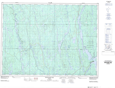
041P13 Mattagami Lake Canada topo map, 1:50,000 scale
041P13 Mattagami Lake NRCAN topographic map.
Includes UTM and GPS geographic coordinates (latitude and longitude). This 50k scale map is suitable for hiking, camping, and exploring, or you could frame it as a wall map.
Printed on-demand using high resolution, on heavy weight and acid free paper, or as an upgrade on a variety of synthetic materials.
Topos available on paper, Waterproof, Poly, or Tyvek. Usually shipping rolled, unless combined with other folded maps in one order.
- Product Number: NRCAN-041P13
- Parent Topo: TOPO-041P
- Map ID also known as: 041P13, 41P13
- Unfolded Size: Approximately 26" high by 36" wide
- Weight (paper map): ca. 55 grams
- Map Type: POD NRCAN Topographic Map
- Map Scale: 1:50,000
- Geographical region: Ontario, Canada
Neighboring Maps:
All neighboring Canadian topo maps are available for sale online at 1:50,000 scale.
Purchase the smaller scale map covering this area: Topo-041P
Spatial coverage:
Topo map sheet 041P13 Mattagami Lake covers the following places:
- Giroux Bay - Southeast Arm - Decker Point - Carter - DesRosiers - Emerald - Frater - Gardhouse - Gouin - Hazen - Jack - Mattagami - Middleboro - Noble - Northrup - Regan - Roblin - Somme - Stetham - Togo - Whalen - Wigle - Mattagami 71 - Mattagami Indian Reserve 71 - Réserve indienne Mattagami 71 - Hawk Island - Ahsine Lake - Akonesi Lake - Akonewi Lake - Beaver Lake - Bell Lake - Boyd Lake - Brady Lake - Collin Lake - Docks Lake - Duguay Lake - George Lake - Gouin Lake - Guitar Lake - Hazen Lake - Hornet Lake - Kapika Lake - Kasasway Lake - Katagi Lake - Katodawa Lake - Kenetogami Lake - Ketchini Lake - Lower Stetham Lake - Makami Lake - Mallet Lake - Mattagami Lake - Mesomikenda Lake - Middle Stetham Lake - Mindedo Lake - Netun Lake - Number Nine Lake - Octave Lake - Opemanah Lake - Pearl Lake - Pineland Lake - Ralph Lake - Robitaille Lake - Robitaille Lake - Rutter Lake - Secret Lake - Soulière Lake - Spence Lake - Stackpool Lake - Stetham Lake - Tatachikapika Lake - Taylor Lake - Trotter Lake - Upper Kasasway Lake - Upper Kenetogami Lake - Wamukuwin Lake - Wawongong Lake - Wee Lake - Whalsom Lake - Whopper Lake - Wine Lake - Wizard Lake - Wright's Lake - Akonesi Chain of Lakes Complex Conservation Reserve - Ahsine Creek - Akonesi Creek - Bent Creek - Gouin Creek - Hazen Creek - Kamiskotia River - Kasasway River - Katagi Creek - Katodawa Creek - Kenetogami Creek - Makami River - Mindedo Creek - Minisinakwa River - Stetham Creek - Tatachikapika River - Wizard Creek - Bethnal - Camp Kenda - Camp Kenogaming - Camp Ketchini - Ketchini Camp - Pineland - Stackpool


