
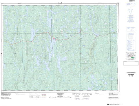
041P10 Gowganda Canada topo map, 1:50,000 scale
041P10 Gowganda NRCAN topographic map.
Includes UTM and GPS geographic coordinates (latitude and longitude). This 50k scale map is suitable for hiking, camping, and exploring, or you could frame it as a wall map.
Printed on-demand using high resolution, on heavy weight and acid free paper, or as an upgrade on a variety of synthetic materials.
Topos available on paper, Waterproof, Poly, or Tyvek. Usually shipping rolled, unless combined with other folded maps in one order.
- Product Number: NRCAN-041P10
- Parent Topo: TOPO-041P
- Map ID also known as: 041P10, 41P10
- Unfolded Size: Approximately 26" high by 36" wide
- Weight (paper map): ca. 55 grams
- Map Type: POD NRCAN Topographic Map
- Map Scale: 1:50,000
- Geographical region: Ontario, Canada
Neighboring Maps:
All neighboring Canadian topo maps are available for sale online at 1:50,000 scale.
Purchase the smaller scale map covering this area: Topo-041P
Spatial coverage:
Topo map sheet 041P10 Gowganda covers the following places:
- Banker Bay - Beaton Bay - Glosser Bay - Gordon Bay - Great South Bay - Inlet Bay - Islet Bay - Miles Bay - Milner Bay - North Arm - Outlet Bay - South Bay - Julian Point - Outlook Point - Rorke Point - Bridal Veil Falls - Charters - Chown - Corkill - Haultain - Knight - Lawson - Leith - Leonard - Mickle - Milner - Nicol - Roadhouse - Timiskaming - Tyrrell - Van Hise - Wallis - Upper Notch Dam - Arkose Island - Hawk Island - Babs Lake - Beauty Lake - Bilsky Lake - Bloom Lake - Bone Lake - Bonsall Lake - Boot Lake - Boyd Lake - Brady Lake - Breeze Lake - Brennan Lake - Brett Lake - Bruce Lake - Bulsch Lake - Burk Lake - Calcite Lake - Callinan Lake - Crawford Lake - Crawford Lake - Cyril Lake - Davidson Lake - Diabase Lake - Dillabough Lake - Dinny Lake - Dobie Lake - Dumond Lake - Duncan Lake - Durkee Lake - Eagle Lake - Edith Lake - Elkhorn Lake - Everett Lake - Firth Lake - Fisher Lake - Flanagan Lake - Flatstone Lake - Foot Lake - Fortune Lake - Fryingpan Lake - Gordon Lake - Gorman Lake - Gould Lake - Gowganda Lake - Grand Lake - Greenshore Lake - Hangingstone Lake - Haultain Lake - Headwater Lake - Hermence Lake - Hilda Lake - Holland Lake - Holt Lake - House Lake - Indian Lake - Irene Lake - Isabel Lake - Island Lake - Jacobs Lake - Jerome Lake - Kawakanika Lake - Kidglove Lake - Kilpatrick Lake - Lafricain Lake - LeHeup Lake - Leroy Lake - Leta Lake - Lett Lake - Lily Lake - Little Southbear Lake - Logan Lake - Long Lake - Longpoint Lake - Lost Lake - Lower Ridge Lake - Margueratt Lake - Martin Lake - McIntosh Lake - McRae Lake - Melia Lake - Metikemedo Lake - Michaels Lake - Miller Lake - Milner Lake - Mire Lake - Molly Lake - Moosecall Lake - Mooseheart Lake - Morton Lake - Mosher Lake - Moss Lake - Myrtle Lake - North Gamble Lake - North Twin Lake - Obushkong Lake - Otter Lake - Owl Lake - Paddle Lake - Pantaloon Lake - Paw Lake - Pear Lake - Penassi Lake - Pettipher Lake - Phelps Lake - Polliwog Lake - Reeve Lake - Ridge Lake - Sandplains Lake - Serpentine Lake - Shack Lake - Shanty Lake - Sigs Lake - Silverfive Lake - Slim Lake - Soot Lake - South Twin Lake - Southbear Lake - Stella Lake - Stem Lake - Stress Lake - Stumpy Lake - Thompson Lake - Tramp Lake - Wallis Lake - Wigwam Lake - Wilson Lake - Wapus Creek Conservation Reserve - West Montreal River Provincial Park - Upper Notch Rapids - Bear River - Breeze Creek - Burgess Creek - Calcite Creek - Coldspring Creek - Diabase Creek - East Wapus Creek - Elkhorn Creek - Firth Creek - Flanagan Creek - Foot Creek - Haines Creek - Hilda Creek - Lawson Creek - McIntosh Creek - Mickle Creek - Miller Creek - Montreal River - North Lady Evelyn River - Shack Creek - Silverfive Creek - Spider Creek - Sydney Creek - Thomson Creek - Wallis Creek - Wapus Creek - West Montreal River - West Wapus Creek - Wilson Creek - Gowganda - O'Brien


